Itinéraire à imprimer
Grand Circle to the Rockies: Zion, Moab, Monument Valley, Mesa Verde and Rocky Mountain
13 jours · Las Vegas à Denver · jusqu'à 12 voyageurs
À partir de CAD 9,215 par personne, en chambre partagée (prix estimé. Prix estimé. L'itinéraire, les hôtels et les disponibilités sont proposés sous réserve de confirmation. Votre devis précisera les conditions de réservation; l'envoi d'une demande ne confirme pas une réservation.)
Jour par jour
Itinéraire
- Las Vegas1 nuit
- Springdale2 nuits
- Bryce Canyon City1 nuit
- Torrey1 nuit
- Moab2 nuits
- Monument Valley1 nuit
- Durango2 nuits
- Alamosa1 nuit
- Estes Park1 nuit
- Denverarrivée
- Étape avec nuitée
- Excursion d'une journée
- En bateau ou en train
Jour 1 : Arrive in Las Vegas
Harry Reid International Airport to your hotel in Las Vegas
- Environ 18 min de route
- Welcome dinner
- Nuit : Las Vegas
Détail du jour 1
Fly into Harry Reid International Airport (LAS), about 15 minutes from the Strip, where a driver meets you in arrivals and takes you to the hotel. Aim to land by about 4 pm so you are settled before the evening meeting; the exact time comes with your final itinerary. Until then the city is yours: rest after the flight, walk the Strip, or watch the fountains in front of the Bellagio. In the early evening your See Sight Tours guide gathers the group at the hotel and walks through the next twelve days: the drive on each day, the two longer days in Colorado, what to pack for slickrock and altitude, how the park entries, the Angels Landing lottery and the Mesa Verde tickets work, and what the weather is likely to do on your dates. Then we head out together for a welcome dinner. We leave for Utah after breakfast tomorrow, so most people make it an early night.
Compris
- Pick-up at Harry Reid International Airport (LAS)
- Welcome meeting with your guide
- Welcome dinner
Temps libre : Free until the evening meeting
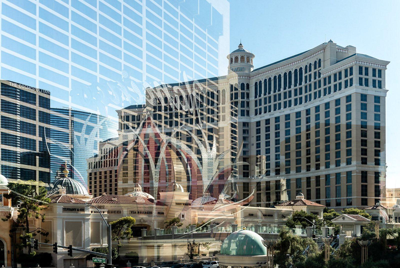
The Bellagio on the Las Vegas Strip Photo: Julian Lupyan, CC0, via Wikimedia Commons (https://commons.wikimedia.org/wiki/File:Reflection_of_the_Flamingo_Hotel_in_front_of_the_Bellagio.jpg) Jour 2 : Las Vegas to Zion
Las Vegas to Springdale at the gate of Zion National Park
- Environ 3 h de route
- Petit-déjeuner et repas du midi
- Nuit : Springdale
Détail du jour 2
After breakfast we drive about 265 km north-east on Interstate 15, through the Virgin River Gorge in the corner of Arizona and into Utah, where the clocks go forward an hour. Past St George and Hurricane the rock turns red, and by lunchtime we reach Springdale, the small town at the south entrance of Zion, our base for two nights. Lunch is sit-down in town. In the afternoon we walk into the park on the Pa'rus Trail, a paved, almost level path beside the Virgin River with the Watchman rising behind it, and take the shuttle to the Zion Human History Museum, whose exhibits and terrace view up the canyon explain what you will walk through tomorrow. As the sun drops we stand on the bridge at Canyon Junction while the Watchman turns orange. Dinner is your choice in Springdale, a short walk from the hotel.
Compris
- Drive from Las Vegas to Springdale with your guide
- Sit-down lunch in Springdale
- The Pa'rus Trail along the Virgin River
- Zion Human History Museum
- The Watchman in evening light from Canyon Junction
Temps libre : Evening free in Springdale
Activité : About 5 km of easy, paved walking.
Jour 3 : Zion Canyon on the first shuttles
Up Zion Canyon by park shuttle, from the Grotto to the Temple of Sinawava
- Petit-déjeuner et repas du midi
- Nuit : Springdale
Détail du jour 3
For most of the year private cars cannot drive Zion Canyon, so we ride the park shuttle and take one of the first buses, while the walls still shade the trails. At the Grotto the group splits. The active walkers climb the West Rim Trail and the tight switchbacks of Walter's Wiggles to Scout Lookout, about 6 km return with about 360 m of climb, with Angels Landing above and the canyon floor far below; anyone who won a permit in the lottery can go on along the chains, with the guide's advice. The easier group walks to the Lower and Middle Emerald Pools, where water drips from an overhanging cliff. Everyone meets for a sit-down lunch in the canyon, then rides to the Temple of Sinawava for the Riverside Walk, where the canyon closes in at the mouth of the Narrows. If the river is open and safe, wade in as far as you like. The late afternoon and evening are free.
Compris
- Zion Canyon shuttle from the first buses
- Guided walk to Scout Lookout, or to the Lower and Middle Emerald Pools
- Sit-down lunch in Zion Canyon
- The Riverside Walk and a paddle into the Narrows when conditions allow
- Angels Landing day-before lottery entry for guests who want to try
Activités en option
- Narrows gear rental (water shoes, neoprene socks, walking pole), booked through us
Option plus facile : The Lower Emerald Pool, about 2 km return on a paved trail, or on to the Middle Pool, about 3.5 km return with a short climb.
Option plus active : Scout Lookout by Walter's Wiggles, about 6 km return with about 360 m of steady climb, three to four hours; Angels Landing beyond it for permit holders.
Temps libre : Late afternoon and evening free in Springdale
Activité : Scout Lookout is steep, partly paved and has little shade on the switchbacks. The Narrows close when the river runs high or after storms, and the park posts water-quality advisories; your guide checks that morning. Angels Landing needs a lottery permit, which we cannot promise.
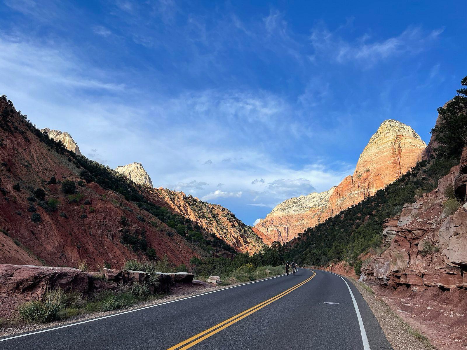
The Zion Canyon Scenic Drive, the shuttle road up the canyon Photo: Vulturesong, CC0, via Wikimedia Commons (https://commons.wikimedia.org/wiki/File:Zion_National_Park_-_HCP_-_October_02,_2022_-_014_-_Zion_Canyon_Scenic_Drive.jpg) Jour 4 : Over the tunnel road to Bryce Canyon
Springdale on the Zion to Mount Carmel Highway, then Red Canyon and Bryce Canyon
- Environ 2 h de route
- Petit-déjeuner et repas du midi
- Nuit : Bryce Canyon City
Détail du jour 4
We leave Springdale after breakfast and climb the Zion to Mount Carmel Highway in switchbacks to its 1.8 km tunnel through the cliff, opened in 1930. Just beyond, we stop for the Canyon Overlook Trail, a short ledge walk to a view down Pine Creek into Zion Canyon, and again at Checkerboard Mesa, its white sandstone cross-hatched like a grid. The road then runs north on US 89 and east on Scenic Byway 12 through the red arches of Red Canyon, about two hours of driving in all. After a sit-down lunch near the park we walk the rim from Sunset Point to Sunrise Point, then drop below it on the Queen's Garden and Navajo Loop trails, among the orange spires called hoodoos. The climb back to the rim, at about 2,400 m, is the hard part. In the evening we watch the light fade from Inspiration Point; dinner is your choice.
Compris
- The Zion to Mount Carmel Highway and tunnel
- Canyon Overlook Trail and Checkerboard Mesa
- Red Canyon on Scenic Byway 12
- Sit-down lunch near Bryce Canyon
- Rim walk from Sunset Point to Sunrise Point
- Queen's Garden and Navajo Loop among the hoodoos
- Evening light at Inspiration Point
Option plus facile : Stay on the rim: the paved section from Sunset to Sunrise Point is about 1 km and nearly level, with benches.
Option plus active : Add the Peekaboo Loop below Bryce Point, about 8 km and steeper, with your guide.
Temps libre : Evening free
Activité : Queen's Garden and Navajo Loop together are about 5 km with about 180 m to climb back up. The Wall Street side of the Navajo Loop closes in winter and sometimes into spring; we use the Two Bridges side then.
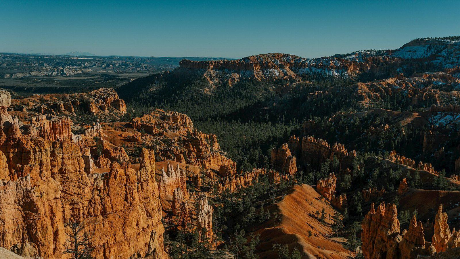
Hoodoos below the rim of Bryce Canyon Photo: Hihifap39, CC0, via Wikimedia Commons (https://commons.wikimedia.org/wiki/File:Majestic_Bryce_Canyon_National_Park_Landscape.jpg) Jour 5 : Bryce sunrise, Scenic Byway 12 and Capitol Reef
Bryce Point to Escalante, Boulder and over Boulder Mountain to Capitol Reef and Torrey
- Environ 3.5 h de route
- Petit-déjeuner et repas du midi
- Nuit : Torrey
Détail du jour 5
The Bryce amphitheatre faces east, so we drive the short way to Bryce Point for sunrise, when the first light picks out the hoodoos row by row, and return for breakfast. Then we follow Scenic Byway 12 east, about three hours of driving with stops: down through Tropic into Grand Staircase-Escalante National Monument, to the Head of the Rocks viewpoint over miles of slickrock, and along the Hogback, a narrow ridge with drops on both sides. Lunch is sit-down in Boulder. The road then climbs over Boulder Mountain through aspen and pine and drops to Capitol Reef, which protects the Waterpocket Fold, a wrinkle in the earth's crust about 160 km long. We spend the afternoon in the park: the Fremont petroglyph panel, the orchards and Gifford Homestead at Fruita, and the Scenic Drive to Capitol Gorge, where a flat walk leads to the Pioneer Register. We sleep in Torrey. It is a certified dark-sky area, and your guide takes anyone who wants to go out to see the stars.
Compris
- Sunrise at Bryce Point
- Scenic Byway 12 through Grand Staircase-Escalante National Monument
- Head of the Rocks viewpoint and the Hogback
- Sit-down lunch in Boulder
- Capitol Reef National Park: the petroglyph panel, Fruita and the Gifford Homestead
- The Scenic Drive and the walk to the Pioneer Register in Capitol Gorge
- Stargazing with your guide
Option plus facile : Skip the sunrise and sleep in; the van leaves after breakfast either way.
Option plus active : Climb to Cassidy Arch from Grand Wash, about 5.5 km return with about 200 m of steep climb, in place of Capitol Gorge.
Temps libre : Evening free in Torrey
Activité : Sunrise at Bryce Point is cold for most of the season; bring a warm layer and gloves. The Capitol Gorge walk is flat on gravel.
Jour 6 : Hickman Bridge, Goblin Valley and Arches
Torrey to Hickman Bridge, Goblin Valley, then Moab and Arches National Park
- Environ 4 h de route
- Petit-déjeuner et repas du midi
- Nuit : Moab
Détail du jour 6
We start early on the Hickman Bridge Trail, whose trailhead sits on Highway 24 on our road east: about 3 km return and 120 m of climb to a natural sandstone bridge, done while the rock is still cool. Then we follow the Fremont River out of the park into the grey Mancos shale badlands around Caineville and, past Hanksville, spend an hour in Goblin Valley State Park among squat, mushroom-shaped rocks. Lunch is a sit-down stop in Green River, then it is east on Interstate 70 and south to Moab, about three and three-quarter hours of driving in all, for two nights. In the afternoon we enter Arches by the main entrance, with a timed entry booked if the park requires one, and see Balanced Rock, the Windows and Double Arch. As the sun goes down we walk to Delicate Arch and watch it turn red; if the day runs late, we see it from the Lower Viewpoint and move the Windows to tomorrow evening. Dinner is your choice in Moab.
Compris
- Hickman Bridge Trail in Capitol Reef
- Highway 24 past the Caineville badlands
- Goblin Valley State Park
- Sit-down lunch in Green River
- Arches National Park: Balanced Rock, the Windows and Double Arch
- Delicate Arch at sunset
Option plus facile : Stay in the van for Hickman Bridge and watch the Delicate Arch sunset from the Lower Viewpoint, a few minutes' walk from the car park.
Option plus active : The full Delicate Arch trail, about 5 km return over open slickrock with about 150 to 190 m of climb, back by headlamp.
Temps libre : Evening free in Moab
Activité : Hickman Bridge climbs on a rocky trail with little shade. The Delicate Arch trail has no shade and ends along a rock ledge; bring a headlamp, and we carry spares.
Jour 7 : Mesa Arch sunrise and Canyonlands
Moab to Island in the Sky in Canyonlands, Dead Horse Point and back to Moab
- Environ 3 h de route
- Petit-déjeuner et repas du midi
- Nuit : Moab
Détail du jour 7
We leave Moab about an hour and a half before sunrise with coffee and a packed breakfast and drive about 50 minutes up to the Island in the Sky, the high mesa of Canyonlands. A short loop trail leads to Mesa Arch on the cliff edge. When the sun clears the La Sal Mountains it lights the underside of the arch red, with the canyons below, and because photographers queue for it we arrive in the dark. Once the crowd thins we drive to Grand View Point, where the White Rim and the canyons of the Green and Colorado rivers open out, and walk along the rim. On the way back we stop at Dead Horse Point State Park, 600 m above a tight bend of the Colorado. We are in Moab for a sit-down lunch, and the afternoon is free: rest, wander Main Street, or book a half-day rafting trip or 4x4 tour. Late in the day your guide takes anyone who wants to go back into Arches for Landscape Arch in Devils Garden.
Compris
- Sunrise at Mesa Arch, with a packed breakfast
- Grand View Point in Canyonlands
- Dead Horse Point State Park
- Sit-down lunch in Moab
- Evening walk to Landscape Arch in Devils Garden, for those who want it
Activités en option
- A rafting trip on the Colorado River, a 4x4 tour or a scenic flight in the free afternoon, priced when you book
Option plus facile : Sit out Landscape Arch and keep the whole afternoon and evening free in Moab.
Option plus active : Walk the Grand View Point Trail to its end, about 3 km return along the rim.
Temps libre : Afternoon free in Moab, and dinner your choice
Activité : The Mesa Arch loop is under 1 km but uneven, and the rim is unfenced. Mornings on the mesa are cold until the sun is up.
Jour 8 : South to Monument Valley
Moab to Bluff, the Goosenecks and Monument Valley Navajo Tribal Park
- Environ 3 h de route
- Petit-déjeuner, repas du midi et repas du soir
- Nuit : Monument Valley
Détail du jour 8
After breakfast we drive south on US 191 past Wilson Arch, a roadside arch you can scramble up to, through Monticello and Blanding to Bluff, a small town on the San Juan River settled by Mormon pioneers in 1880. Lunch is sit-down in Bluff, with time for the reconstructed cabins of Bluff Fort. Past Mexican Hat we turn off to Goosenecks State Park, where the San Juan has cut tight loops some 300 m deep into the rock. Then the buttes of Monument Valley rise ahead, about three hours of driving in all. Monument Valley is a Navajo Tribal Park, and most of the valley floor can only be visited with a Navajo guide. In the afternoon we join one in an open tour vehicle on the valley drive and onto tracks closed to private cars, to arches, rock art and the views beneath the Mittens, and stay out for the sunset. There are few restaurants here, so dinner is included at the hotel tonight.
Compris
- Wilson Arch
- Sit-down lunch in Bluff and Bluff Fort
- Goosenecks State Park
- Monument Valley Navajo Tribal Park entry
- Afternoon valley tour with a Navajo guide, including areas closed to private vehicles, until sunset
- Dinner at the hotel
Option plus facile : Stay with the tour vehicle at each stop; the valley tour needs very little walking.
Option plus active : Walk the Wildcat Trail around West Mitten Butte, about 6 km on sand, early in the afternoon before the tour.
Activité : The valley tracks are sandy and bumpy, and the open vehicles are dusty; a scarf or buff helps. Photographing people or homes on the Navajo Nation needs permission first; your Navajo guide will tell you where it is welcome.
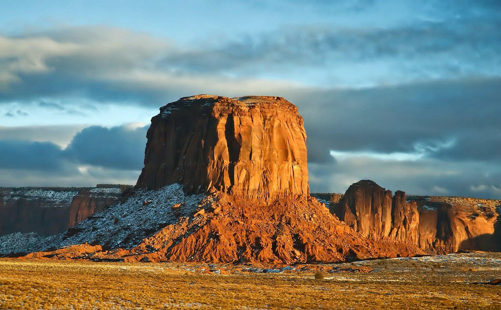
Late light on a butte in Monument Valley Photo: Dawn Armfield darmfield, CC0, via Wikimedia Commons (https://commons.wikimedia.org/wiki/File:Oljato-Monument_Valley,_United_States_(Unsplash_R9S19dOFlcs).jpg) Jour 9 : Sunrise over the buttes, then Durango
Monument Valley to Bluff, the Four Corners Monument and Cortez, then Durango
- Environ 3.5 h de route
- Petit-déjeuner et repas du midi
- Nuit : Durango
Détail du jour 9
The Mittens and Merrick Butte stand east of the visitor centre, so sunrise rises behind them, and the hotel is close enough that you can watch it from the overlook before breakfast. We leave at about 8:30 and drive back through Bluff, then east along the San Juan River through Montezuma Creek to the Four Corners Monument, the only point in the United States where four states meet: Utah, Arizona, New Mexico and Colorado. Navajo vendors sell jewellery and fry bread around the plaza. From here we cross into Colorado, have a sit-down lunch in Cortez, and continue past the long flank of Mesa Verde to Durango, about three and a half hours of driving in all, where we stay two nights. The afternoon and evening are free in Durango's old downtown, a railroad town of brick buildings along Main Avenue, with the narrow-gauge train station at its southern end and the Animas River a short walk away.
Compris
- Sunrise over the Mittens from the overlook
- Four Corners Monument entry
- Sit-down lunch in Cortez
- Drive along the San Juan River into Colorado
Activités en option
- An extra night in Durango to ride the Durango and Silverton Narrow Gauge Railroad, booked on request
Temps libre : Afternoon and evening free in Durango
Activité : The Four Corners Monument is run by Navajo Nation Parks; some stalls take cash only.
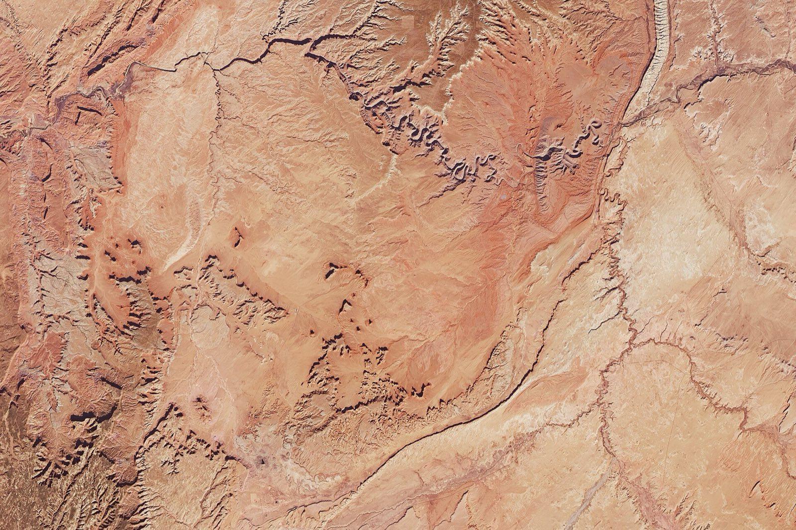
Monument Valley seen from orbit by Landsat 8 Photo: Landsat-8, Joshua Stevens, Mike Taylor, Public domain, via Wikimedia Commons (https://commons.wikimedia.org/wiki/File:Monument_Valley_Landsat_8.jpg) Jour 10 : Mesa Verde with a park ranger
Durango to Chapin Mesa in Mesa Verde National Park and back
- Environ 3 h de route
- Petit-déjeuner et repas du midi
- Nuit : Durango
Détail du jour 10
Mesa Verde, a UNESCO World Heritage Site, protects the villages Ancestral Pueblo people built between about 600 and 1300, including houses tucked into alcoves in the canyon walls. We leave Durango at about 7:30 and drive about an hour and a quarter, the last stretch on the winding park road up onto Chapin Mesa. The cliff dwellings can only be entered on ranger-led tours, so we book tickets for the group as soon as your dates are set. The usual choice is Cliff Palace, about an hour with several short ladders and stone steps, and the more adventurous can take Balcony House, with a 10 m ladder and a tight crawl through a tunnel. Around the tour we visit the Chapin Mesa Archeological Museum, look down on Spruce Tree House from its overlook, and have a sit-down lunch in the park. In the afternoon we drive the Mesa Top Loop past pithouses, Sun Temple and the overlooks across the canyon, and are back in Durango by early evening.
Compris
- Mesa Verde National Park entry
- Ranger-led tour of Cliff Palace or Balcony House
- Chapin Mesa Archeological Museum and the Spruce Tree House overlook
- Sit-down lunch in the park
- The Mesa Top Loop and Sun Temple
Option plus facile : Skip the ladders and see Cliff Palace from the overlook and the Mesa Top Loop sites, all short, level walks.
Option plus active : The Balcony House tour, with a 10 m ladder, a crawl through a 4 m tunnel and an exposed climb out; book it when you book the trip.
Temps libre : Evening free in Durango
Activité : Ranger tours run from late spring to autumn, tickets are limited and the park may change which dwellings are open; we confirm yours before departure. The mesa sits at about 2,100 m.
Jour 11 : Wolf Creek Pass to the Great Sand Dunes
Durango to Pagosa Springs, over Wolf Creek Pass and across the San Luis Valley to Great Sand Dunes, then Alamosa
- Environ 4.5 h de route
- Petit-déjeuner et repas du midi
- Nuit : Alamosa
Détail du jour 11
Today runs a little over the four-hour limit, about four and a quarter hours of driving, because the Great Sand Dunes sit across the San Juan Mountains from Durango; we break it into two halves. In the morning we drive east to Pagosa Springs, where steaming hot springs line the San Juan River, for an early sit-down lunch. Then US 160 climbs past Treasure Falls, where we stop, to Wolf Creek Pass, 3,307 m on the Continental Divide, and drops into the San Luis Valley, flat and wide between two ranges. In the middle of the afternoon the dunes appear against the Sangre de Cristo Mountains; they include the tallest in North America. We walk out across Medano Creek, which usually flows in late spring and early summer, and climb the sand as far as you like while it cools and the evening light picks out the ridges. Then it is 40 minutes to Alamosa for the night, with dinner your choice.
Compris
- Sit-down lunch in Pagosa Springs
- Treasure Falls and Wolf Creek Pass on the Continental Divide
- Great Sand Dunes National Park entry
- Medano Creek and a walk on the dunes in evening light
Option plus facile : Stay on the flat sand by Medano Creek near the main car park, a few minutes' walk.
Option plus active : Climb to the top of High Dune, about 4 km return and about 200 m of climb up soft sand.
Temps libre : Late evening free in Alamosa
Activité : The sand gets hot enough to burn bare feet on summer afternoons, which is why we go late in the day; wear closed shoes. The dunes sit at about 2,500 m, so climbing sand is slow work.
Jour 12 : Over the passes to Rocky Mountain National Park
Alamosa to Poncha Pass, Buena Vista and Kenosha Pass, then Boulder and Estes Park
- Environ 5.5 h de route
- Petit-déjeuner, repas du midi et repas du soir
- Nuit : Estes Park
Détail du jour 12
This is the longest drive of the trip, about five hours, and we say so plainly: no shorter road links the San Luis Valley with Rocky Mountain National Park, and ending in Denver instead would cut the park. We leave Alamosa at about 7:30 and break the day up. The road runs north up the valley and over Poncha Pass into the Arkansas River valley, where we stop for a sit-down lunch in Buena Vista beneath the Collegiate Peaks, several of them over 4,200 m. Then we cross the open grassland of South Park and stop at Kenosha Pass, where aspen groves turn gold in September, before dropping to the foothills and running north past Boulder to Estes Park, the gateway town to the park, at about 4 pm. After a rest we drive into Moraine Park, where elk graze the meadows at dusk and, in September, the bulls bugle. Then we gather for the farewell dinner in Estes Park.
Compris
- Poncha Pass and the Arkansas River valley
- Sit-down lunch in Buena Vista
- Kenosha Pass viewpoint
- Rocky Mountain National Park entry
- Evening elk watching in Moraine Park
- Farewell dinner in Estes Park
Option plus facile : Skip the evening drive into Moraine Park and rest before dinner.
Temps libre : Free between arrival and the evening drive
Activité : We stop at least every 90 minutes. Keep at least 25 m from elk, and more in the September rut.
Jour 13 : Bear Lake morning, then Denver
Estes Park to Bear Lake Road in Rocky Mountain National Park, then Denver International Airport
- Environ 2.5 h de route
- Petit-déjeuner
Détail du jour 13
We leave Estes Park at about 7 am with a packed breakfast and drive up Bear Lake Road, where the car parks fill early, using a timed entry if the park requires one. At Bear Lake, about 2,900 m up, the easy group walks the level loop around the lake, under 1 km, with Hallett Peak reflected in still mornings. The active group climbs past Nymph Lake to Dream Lake, about 3.5 km return with about 130 m of climb, with the option to go on to Emerald Lake below the cliffs of Hallett Peak, about 6 km return. We are back in Estes Park by about 10:30, then drive through the canyon of the St Vrain to Lyons and past Boulder to Denver International Airport (DEN), about 120 km and an hour and three-quarters, arriving about 12:30 to 1 pm. Book flights leaving after about 4 pm. Your guide sees you to departures; if you would rather stay on, we can drop you in downtown Denver and book an extra night.
Compris
- Bear Lake Road in Rocky Mountain National Park, with any timed entry the park requires
- Bear Lake loop, or Nymph and Dream Lakes
- Drop-off at Denver International Airport (DEN)
Activités en option
- Extra nights in Denver, booked on request
Option plus facile : The Bear Lake loop, under 1 km and nearly level.
Option plus active : Dream Lake, about 3.5 km return with about 130 m of climb, or on to Emerald Lake, about 6 km return with about 185 m.
Activité : Book a flight leaving after about 4 pm. Early mornings at Bear Lake are cold, even in summer.
Faune et météo : Late spring and early autumn give warm days in the Utah desert and cool, clear mornings in Colorado. In midsummer Zion, Moab and the sand at the dunes run very hot, and afternoon storms can close the Narrows and bring lightning to the high country, so walks start early. Bryce and Wolf Creek Pass can have snow in late May and again from October. Medano Creek at the dunes usually flows in late spring and early summer and is often dry by late summer. Watch for mule deer in Capitol Reef, pronghorn near Bryce, and elk in the meadows of Rocky Mountain National Park, where September is the rut and the bulls bugle at dusk.
12 nuits
Où vous logerez
Vos hôtels sont nommés dans la confirmation de votre voyage.
- Las Vegas1 nuit
- Springdale2 nuits
- Bryce Canyon City1 nuit
- Torrey1 nuit
- Moab2 nuits
- Monument Valley1 nuit
- Durango2 nuits
- Alamosa1 nuit
- Estes Park1 nuit
Un seul prix
Ce que le prix comprend
Compris
Hébergement
- 12 nights: 1 in Las Vegas, 2 in Springdale at the gate of Zion, 1 in Bryce Canyon City by the park entrance, 1 in Torrey for Capitol Reef, 2 in Moab, 1 at Monument Valley, 2 in Durango, 1 in Alamosa for the Great Sand Dunes, 1 in Estes Park for Rocky Mountain
- Rooms shared, or your own for a supplement
- The Las Vegas resort fee
Transport
- Pick-up at Harry Reid International Airport (LAS) in Las Vegas and drop-off at Denver International Airport (DEN)
- Our own air-conditioned vehicle and driver for the group, with a seat for every guest and room for luggage
- Zion Canyon shuttle buses inside Zion
- The Monument Valley valley tour in a Navajo guide's open tour vehicle
Votre guide
- A See Sight Tours guide with the group for the whole trip, who leads the walks and handles park entries, timed tickets and permit lotteries
- A Navajo guide for the Monument Valley valley tour
- A National Park Service ranger for the Mesa Verde cliff dwelling tour
Activités
- Zion National Park: the Pa'rus Trail, Human History Museum, Scout Lookout or the Emerald Pools, the Riverside Walk and the Narrows when open
- Angels Landing day-before lottery entry and permit fees for guests who want to try
- The Zion to Mount Carmel Highway and the Canyon Overlook Trail
- Bryce Canyon National Park: the rim walk, Queen's Garden and Navajo Loop, sunrise at Bryce Point
- Scenic Byway 12, Head of the Rocks and the Hogback
- Capitol Reef National Park: the petroglyphs, Fruita, the Scenic Drive, Capitol Gorge and Hickman Bridge
- Goblin Valley State Park
- Arches National Park, with timed entry where the park requires it: the Windows, Double Arch, Delicate Arch at sunset and Landscape Arch
- Canyonlands National Park: sunrise at Mesa Arch and Grand View Point
- Dead Horse Point State Park
- Goosenecks State Park and Bluff Fort
- Monument Valley Navajo Tribal Park entry and the Navajo-guided valley tour until sunset
- The Four Corners Monument
- Mesa Verde National Park: a ranger-led tour of Cliff Palace or Balcony House, the museum and the Mesa Top Loop
- Great Sand Dunes National Park and Medano Creek
- Rocky Mountain National Park: Moraine Park at dusk and Bear Lake, with any timed entry the park requires
Repas
- Breakfast daily (12), with packed breakfasts for the Mesa Arch sunrise and the Bear Lake morning
- Lunch on days 2 to 12 (11)
- Welcome dinner in Las Vegas, dinner at Monument Valley and farewell dinner in Estes Park (3)
Non compris
- International flights to Las Vegas and home from Denver
- US visa or ESTA
- Travel insurance
- The National Park Service fee for visitors who are not US residents at Zion, Bryce Canyon and Rocky Mountain (from 2026, USD 100 per person aged 16 and over at each), where it applies
- Dinners on days 2 to 7 and 9 to 11
- Lunch on day 13
- Drinks, other than water, coffee and tea with included meals
- Tips for your guide, driver and local guides
- Optional activities: rafting, 4x4 tours and scenic flights in Moab, hot springs in Pagosa Springs
- Narrows gear rental
- Personal expenses
Suppléments
- Chambre individuelle
- CAD 1,565 (prix estimé)

See Sight Tours offre des services de voyage partout en Amérique du Nord depuis 2006. Présente dans 20 villes au Canada et aux États-Unis, l'entreprise se spécialise dans les tours en petit groupe qui offrent des expériences personnalisées et de grande qualité aux voyageurs.


Liens rapides
Réservez votre tour
Communiquez avec nous
- Sans frais1-888-961-6584
- Local1-289-271-9767
- Courrielinfo@seesight-tours.com


© 2026 See Sight Tours. Tous droits réservés.