Itinéraire à imprimer
Blue Ridge Parkway and the Great Smoky Mountains: Asheville to Knoxville
7 jours · Asheville à Knoxville · jusqu'à 12 voyageurs
À partir de CAD 5,040 par personne, en chambre partagée (prix estimé. Prix estimé. L'itinéraire, les hôtels et les disponibilités sont proposés sous réserve de confirmation. Votre devis précisera les conditions de réservation; l'envoi d'une demande ne confirme pas une réservation.)
Jour par jour
Itinéraire
Le trajet le plus long dure 3.5 h, le jour 6.
- Asheville3 nuits
- Bryson City1 nuit
- Gatlinburg2 nuits
- Knoxvillearrivée
- Étape avec nuitée
- Excursion d'une journée
- En bateau ou en train
Jour 1 : Arrive in Asheville
Asheville Regional Airport to your hotel in downtown Asheville
- Environ 30 min de route
- Welcome dinner
- Nuit : Asheville
Détail du jour 1
Fly into Asheville Regional Airport (AVL), about 25 km south of the city, in time for the evening briefing: plan to land by about 3 pm (the exact latest arrival is confirmed with your final itinerary). A driver meets you at arrivals for the half-hour run into town. Asheville sits where the Swannanoa River meets the French Broad, ringed by the Blue Ridge, and its downtown is compact enough to cover on foot. At 6 pm your See Sight Tours guide meets the group for a short briefing on the week: what to pack for the summits, how the bear-watching morning works and how the days are paced. Then a short walk through downtown in the evening light, past the Art Deco City Hall, the Grove Arcade and Pack Square, to a welcome dinner together at a downtown restaurant we name when we confirm your dates, with Southern Appalachian cooking on the menu.
Compris
- Pick-up at Asheville Regional Airport (AVL)
- Welcome briefing with your guide
- Evening walk through downtown Asheville
- Welcome dinner
Temps libre : Free until the evening briefing
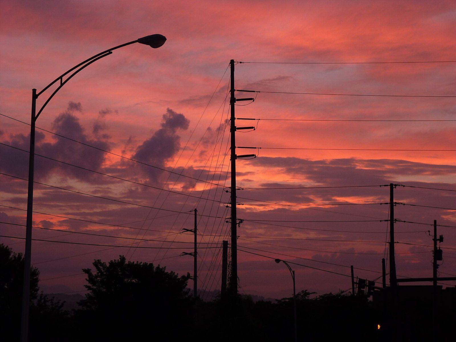
Sunset over Asheville on a summer evening Photo: nschouterden, CC BY 2.0, via Wikimedia Commons (https://commons.wikimedia.org/wiki/File:Asheville,_North_Carolina_July_2013_-_Sky.jpg) Jour 2 : Biltmore and the River Arts District
Asheville to the Biltmore Estate, then the River Arts District
- Environ 30 min de route
- Petit-déjeuner et repas du midi
- Nuit : Asheville
Détail du jour 2
We are at the Biltmore Estate gates as they open, so the first rooms of the house are quiet. George Vanderbilt opened Biltmore House in 1895, and with about 250 rooms it is still the largest privately owned house in the United States. You go through at your own pace: the Banquet Hall, the library of some 10,000 volumes, the servants' quarters and kitchens below stairs. Outside, the gardens and grounds were laid out by Frederick Law Olmsted, and the walk down through the Italian Garden and the Walled Garden to the Conservatory is the best of them. Lunch is a sit-down meal at one of the estate's restaurants, then time at Antler Hill Village. Any winery tasting is optional and paid by you on the day. Mid-afternoon we drive along the French Broad to the River Arts District, old brick mills and warehouses turned into working studios, many of them reopened after the 2024 flood and some still rebuilding. Your guide takes you to see potters, glassblowers and painters at work. The evening is free.
Compris
- Biltmore admission at opening: the house, the gardens and the Conservatory
- Sit-down lunch on the estate
- Antler Hill Village (any winery tasting is optional and self-paid)
- The River Arts District studios with your guide
Option plus facile : Skip the long garden walk and take the estate shuttle, or go back to the hotel after lunch instead of the studios.
Option plus active : Walk the estate's paths down to the Lagoon for the view back to the house, about 3 km more.
Temps libre : Evening free in downtown Asheville
Activité : A long day on your feet, about 6 km through the house, with stairs, and the gardens; there is a lift in the house. What Biltmore's admission includes (audio guide, any winery tasting) changes; no tasting or audio guide is promised from year to year; we confirm it with your dates.
Jour 3 : The Parkway to Craggy Gardens and Mount Mitchell
Asheville north on the Blue Ridge Parkway to Craggy Gardens and Mount Mitchell, then back to Asheville
- Environ 3 h de route
- Petit-déjeuner et repas du midi
- Nuit : Asheville
Détail du jour 3
Today is the Blue Ridge Parkway, the 755 km road along the crest of the Appalachians from Shenandoah to the Smokies, with no billboards, no trucks and a speed limit of 45 mph at most. The stretch from Asheville to Mount Mitchell reopened in September 2025 after Hurricane Helene. We join it at the edge of the city and climb north past the overlooks to Craggy Gardens, where a short trail through rhododendron tunnels leads to Craggy Pinnacle and a bare rock summit with a view over the Black Mountains. Lunch is a picnic we bring from Asheville, eaten at an overlook. In the afternoon we turn up NC 128 into Mount Mitchell State Park, where a short, steep paved path leads to the summit platform at 2,037 metres, the highest point east of the Mississippi, with spruce and fir around you and the ridges falling away in every direction. We come back down the same road, with stops at the overlooks we passed in the morning light, and are in Asheville by late afternoon.
Compris
- The Blue Ridge Parkway from Asheville to Mount Mitchell with stops at the overlooks
- The Craggy Pinnacle trail at Craggy Gardens
- Picnic lunch on the Parkway
- Mount Mitchell State Park and the summit platform
Option plus facile : Stay at the Craggy Gardens and Mount Mitchell car parks, both with long views, or walk only the first level part of each path.
Option plus active : Walk the Black Mountain Crest Trail from the Mount Mitchell summit car park toward Mount Craig, about 3 km there and back on rocky trail.
Temps libre : Late afternoon and evening free
Activité : Mount Mitchell is often in cloud and much cooler than Asheville; bring a warm layer. Parkway repairs mean some sections run at 35 mph with one-lane controls. If a section is closed for repair or weather, your guide uses the nearest open section. If the Parkway north of Mount Mitchell has reopened by your dates, we may add Linville Falls.
Jour 4 : Cherokee and the Nantahala Gorge
Asheville to Cherokee, the Nantahala Gorge, then Bryson City
- Environ 2.5 h de route
- Petit-déjeuner et repas du midi
- Nuit : Bryson City
Détail du jour 4
We check out after breakfast and drive west about an hour and a quarter to Cherokee, on the Qualla Boundary, home of the Eastern Band of Cherokee Indians. At the Museum of the Cherokee People you follow some 11,000 years of history in these mountains, from the first hunters through the Cherokee syllabary to the removal of 1838 on the Trail of Tears and the families who stayed. Just outside town is the Oconaluftee Visitor Center and its Mountain Farm Museum, log buildings moved from around the park, where elk often graze in the fields. Lunch is a sit-down meal in Cherokee. In the afternoon we drive into the Nantahala Gorge, so steep the sun reaches the river only around midday, and walk from the footbridge where the Appalachian Trail crosses the river at the Nantahala Outdoor Center, watching the rafts and kayaks come down. We reach Bryson City, a small railroad town on the Tuckasegee River, by late afternoon; the evening is free.
Compris
- The Museum of the Cherokee People in Cherokee
- The Mountain Farm Museum at Oconaluftee
- Sit-down lunch in Cherokee
- A walk in the Nantahala Gorge with your guide
Activités en option
- Guided half-day rafting on the Nantahala River in season (late spring to early autumn), paid on the day
Option plus facile : Watch the rafts from the riverside terrace at the Nantahala Outdoor Center instead of the trail.
Option plus active : Walk further up the Appalachian Trail from the river, about 4 km there and back with a steady climb.
Temps libre : Evening free in Bryson City
Activité : The Nantahala's water is cold all year, even in summer.
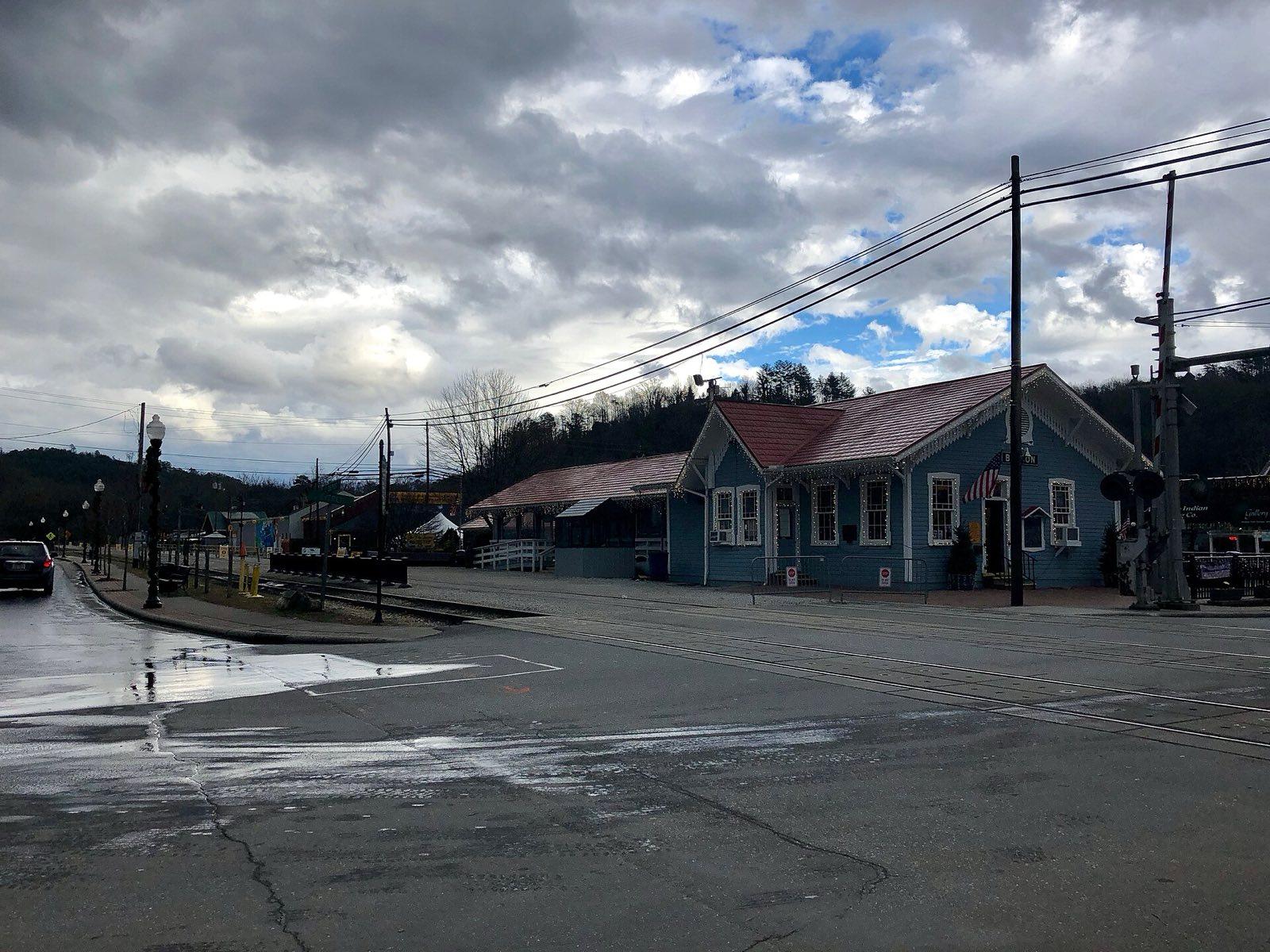
The depot in Bryson City, our stop for one night Photo: Warren LeMay from Cincinnati, OH, United States, CC0, via Wikimedia Commons (https://commons.wikimedia.org/wiki/File:Bryson_City_Depot,_Bryson_City,_NC_(39682818673).jpg) Jour 5 : Over the Smokies by Kuwohi
Bryson City to Newfound Gap Road and Kuwohi, back to Newfound Gap, then Gatlinburg
- Environ 2 h de route
- Petit-déjeuner et repas du midi
- Nuit : Gatlinburg
Détail du jour 5
A short morning walk past the Bryson City depot, where the Great Smoky Mountains Railroad starts its excursions, then we drive into Great Smoky Mountains National Park by Cherokee and climb Newfound Gap Road through hardwood forest into spruce and fir. Just below Newfound Gap we turn onto the Kuwohi road, aiming to reach the summit car park early, before it fills, which in October it does by late morning. Kuwohi, called Clingmans Dome until 2024, is the highest point in the Smokies at 2,025 metres; a steep paved path of about 0.8 km leads to the observation tower and its long view over ridge after ridge of blue haze. We drive back down to Newfound Gap for our stop on the Tennessee state line, where the Appalachian Trail crosses and Franklin Roosevelt dedicated the park in 1940. Then we wind down into Tennessee to Gatlinburg for a sit-down lunch. The afternoon and evening are free: the Sugarlands Visitor Center, a walk along the river, or a rest before tomorrow's early start.
Compris
- Newfound Gap Road across the Smokies with stops at the overlooks
- Kuwohi summit path and observation tower
- Newfound Gap and the Rockefeller Memorial
- Sit-down lunch in Gatlinburg
- Great Smoky Mountains National Park parking tags
Activités en option
- In June, an evening at Elkmont for the synchronous fireflies, only if the park's lottery parking passes allow it
Option plus facile : Stay at the Kuwohi car park, which has the view west over the mountains without the climb.
Option plus active : Walk a stretch of the Appalachian Trail from Newfound Gap, about 3 km there and back.
Temps libre : Afternoon and evening free in Gatlinburg
Activité : The Kuwohi summit is often 8 to 10 degrees Celsius cooler than Gatlinburg; the summit road is open from spring to the end of November.
Jour 6 : Cades Cove at dawn and Laurel Falls
Gatlinburg to Cades Cove, Townsend and Laurel Falls, then back to Gatlinburg
- Environ 3.5 h de route
- Petit-déjeuner, repas du midi et repas du soir
- Nuit : Gatlinburg
Détail du jour 6
The one early start of the week: we leave Gatlinburg about an hour before sunrise (about 6:45 am in October, 5:20 am in June; the exact time is confirmed with your dates) and follow Little River Road to Cades Cove, a broad valley ringed by mountains where farming families lived until the park was created. We enter the 18 km one-way loop as it opens at sunrise and the mist lifts off the fields, which is when black bears, white-tailed deer and wild turkeys are out. Your guide drives at walking pace and stops when there is something to see, always at a safe distance, and we eat a packed breakfast at a pull-off. Then come the log cabins, the Primitive Baptist and Methodist churches and the Cable Mill, before the cars build up mid-morning. Lunch is a sit-down meal in Townsend. On the way back we walk the paved trail to Laurel Falls, a two-tier waterfall in the forest, about 4 km there and back. We are in Gatlinburg by mid-afternoon for a rest before the farewell dinner.
Compris
- Cades Cove Loop Road at sunrise with your guide
- Packed breakfast in the cove
- The John Oliver Cabin, the cove churches and the Cable Mill
- Sit-down lunch in Townsend
- The Laurel Falls trail
- Farewell dinner in Gatlinburg
Option plus facile : Stay with the van on the loop and skip the Laurel Falls walk, or walk only the first level stretch of the trail.
Option plus active : Swap Laurel Falls for the trail to Abrams Falls from Cades Cove, about 8 km there and back with some climbing.
Temps libre : Late afternoon free before the farewell dinner
Activité : An early start: we leave Gatlinburg about 6:45 am in October and about 5:20 am in June, to reach the loop entrance as it opens at sunrise, confirmed with your dates. Cades Cove Loop Road is closed to cars on Wednesdays from early May to late September, so June departures are scheduled around it.
Jour 7 : Knoxville and home
Gatlinburg to downtown Knoxville, then McGhee Tyson Airport
- Environ 2 h de route
- Petit-déjeuner
Détail du jour 7
After a later breakfast we leave the mountains and drive about an hour and a quarter to Knoxville, on the Tennessee River. Your guide walks the group from Market Square, the city's old market place now ringed by cafes, along Gay Street with its theatres to World's Fair Park, built for the 1982 World's Fair. The gold-glass Sunsphere still stands over it, and from its observation level, when open, you look back east to the line of the Smokies you have just crossed. Lunch is your own choice in the city before the half-hour drive to McGhee Tyson Airport (TYS); book a flight leaving after about 3 pm to see Knoxville, or we go straight to the airport. Your guide sees you to the airport and checks your flight before saying goodbye. If you are carrying on to Nashville, about three and a half hours west by road, or to our Nashville, Memphis and New Orleans trip, we can drop you downtown instead.
Compris
- Walk through downtown Knoxville: Market Square, Gay Street and World's Fair Park
- The Sunsphere
- Drop-off at McGhee Tyson Airport (TYS) or downtown Knoxville
Option plus facile : If your flight leaves before about 2 pm, we go straight from Gatlinburg to the airport, about an hour.
Temps libre : Lunch on your own in Knoxville
Activité : Book a flight leaving after about 3 pm to see Knoxville.
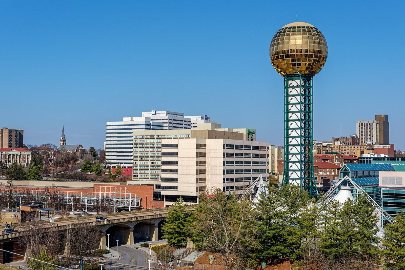
The Sunsphere in Knoxville, built for the 1982 World's Fair Photo: David Ratledge, CC BY 4.0, via Wikimedia Commons (https://commons.wikimedia.org/wiki/File:The_Sunsphere_-_Knoxville,_Tennessee_-_March_8,_2014.jpg)
Faune et météo : October brings the colour, starting high on Mount Mitchell and Kuwohi in early October and reaching the valleys by late October; it varies with the year, and so does the crowd at the overlooks. June is warm in the valleys, cool on the summits, green and full of rhododendron and mountain laurel, with afternoon thunderstorms. The synchronous fireflies usually flash from late May to mid June. Black bears, white-tailed deer and wild turkeys are most active at dawn and dusk; elk graze in the fields at Oconaluftee.
6 nuits
Où vous logerez
Vos hôtels sont nommés dans la confirmation de votre voyage.
- Asheville3 nuits
- Bryson City1 nuit
- Gatlinburg2 nuits
Un seul prix
Ce que le prix comprend
Compris
Hébergement
- 6 nights in central hotels of at least 3-star-plus standard: 3 in downtown Asheville, 1 in Bryson City, 2 in Gatlinburg
- We name each hotel when we confirm your dates
- Rooms shared, or your own for a supplement
Transport
- Pick-up at Asheville Regional Airport (AVL) and drop-off at McGhee Tyson Airport (TYS), Knoxville, or downtown Knoxville
- A private air-conditioned van and driver for the group for the whole trip
- Great Smoky Mountains National Park parking tags
Votre guide
- A See Sight Tours guide for the whole trip, on every walk and at every meal we share
Activités
- Biltmore admission in Asheville: the house, the gardens and Antler Hill Village
- The River Arts District studios in Asheville
- The Blue Ridge Parkway from Asheville to Mount Mitchell
- The Craggy Pinnacle trail at Craggy Gardens
- Mount Mitchell State Park and the summit
- The Museum of the Cherokee People in Cherokee
- The Mountain Farm Museum at Oconaluftee
- A walk in the Nantahala Gorge
- Kuwohi and Newfound Gap in Great Smoky Mountains National Park
- Cades Cove at sunrise
- The Laurel Falls trail
- Downtown Knoxville and the Sunsphere
Repas
- 6 breakfasts, one of them packed for Cades Cove
- 4 sit-down lunches (days 2, 4, 5 and 6) and a picnic lunch on the Parkway (day 3)
- Welcome dinner in Asheville
- Farewell dinner in Gatlinburg
Non compris
- International and domestic flights to Asheville and from Knoxville
- US entry: visa or ESTA fees where they apply
- Travel insurance
- Meals not listed, including lunch on day 7 and four dinners
- Drinks, including wine tastings
- Tips for your guide and driver
- Optional activities: Nantahala rafting, the Great Smoky Mountains Railroad, the Elkmont firefly evening
- Personal expenses
Suppléments
- Chambre individuelle
- CAD 860 (prix estimé)

See Sight Tours offre des services de voyage partout en Amérique du Nord depuis 2006. Présente dans 20 villes au Canada et aux États-Unis, l'entreprise se spécialise dans les tours en petit groupe qui offrent des expériences personnalisées et de grande qualité aux voyageurs.


Liens rapides
Réservez votre tour
Communiquez avec nous
- Sans frais1-888-961-6584
- Local1-289-271-9767
- Courrielinfo@seesight-tours.com


© 2026 See Sight Tours. Tous droits réservés.