Printable itinerary
Western USA: San Francisco, Yosemite, Las Vegas, the Grand Canyon and Los Angeles
14 days · San Francisco to Los Angeles · up to 12 guests
From CAD 8,770 per person, sharing a room (estimated price. Estimated price. The itinerary, hotels and availability are proposed and subject to confirmation. Your quote will set out the booking conditions; sending a request does not confirm a booking.)
Day by day
Itinerary
- San Francisco2 nights
- Yosemite National Park2 nights
- Death Valley National Park1 night
- Las Vegas1 night
- Springdale (Zion)2 nights
- Grand Canyon South Rim2 nights
- Twentynine Palms (Joshua Tree)1 night
- Santa Monica (Los Angeles)2 nights
- Los Angelesend
- Overnight stop
- Day trip
- By boat or train
Day 1: Arrive in San Francisco
San Francisco International Airport (SFO) to a central San Francisco hotel
- Welcome dinner
- Stay in San Francisco
Day 1 details
Fly into San Francisco International Airport (SFO), about 25 km south of the city. We run airport pick-ups in set windows through the day and send the times with your final itinerary, so there is no taxi queue to deal with after a long flight. The hotel is central, close to Union Square and the cable car lines, which makes the rest of the afternoon easy to fill on foot: the Ferry Building and its food hall on the Embarcadero, Chinatown's Grant Avenue, or North Beach for coffee. If you land early, the hills above the hotel give the first views of the bay. At 6 pm your See Sight Tours guide meets the group in the hotel for a short briefing on the two weeks ahead: the route, the driving times, the early starts that matter and the days you can sleep in. Then we walk to a welcome dinner together, the first of five group dinners on the trip, and an early night before tomorrow's walk across the Golden Gate Bridge.
Included
- Pick-up at San Francisco International Airport (SFO) in set windows
- Welcome briefing with your See Sight Tours guide
- Welcome dinner in San Francisco
Free time: Afternoon free in central San Francisco
Activity: Arrive by about 4 pm to make the briefing; earlier flights are easy, as the hotel holds bags until check-in.
Day 2: The Golden Gate Bridge, a cable car and Alcatraz
San Francisco: the Golden Gate Bridge, the Presidio, the Powell and Hyde cable car, Fisherman's Wharf and Alcatraz
- Drive about 45 min
- Breakfast and lunch
- Stay in San Francisco
Day 2 details
We start at the Golden Gate Bridge while the morning is quiet, often with fog still lying under the deck. From the Welcome Center at the south end, walk out along the east sidewalk as far as the first tower or further, with the city skyline behind you and the Marin Headlands ahead; it is about 2.7 km to the far side if you want to go all the way. Back in town we ride the Powell and Hyde cable car over Russian Hill, past the top of Lombard Street, down to Fisherman's Wharf, where lunch is a sit-down meal near the water. In the afternoon the ferry from Pier 33 takes us to Alcatraz, the former federal prison on its island in the bay. The audio tour of the cell house is told by former guards and inmates, and the island's gardens and the view back to the city are worth the walk up the steep path. We are back on the mainland by late afternoon, and the evening is free for North Beach, Chinatown or the Mission.
Included
- Golden Gate Bridge walk from the Welcome Center with your guide
- Powell and Hyde cable car ride to Fisherman's Wharf
- Sit-down lunch at Fisherman's Wharf
- Alcatraz ferry from Pier 33 and the cell house audio tour
Easier option: Walk to the first tower of the bridge and back, about 2 km, and ride the island tram up from the Alcatraz dock instead of taking the steep path (the tram runs on a set schedule).
More active option: Walk the whole bridge to the Vista Point on the Marin side, about 5.5 km there and back.
Free time: Evening free
Activity: Alcatraz tickets sell out weeks ahead; we book them with your place. San Francisco summers are cool and windy: bring a warm layer even in July.
Day 3: Across the Central Valley to Yosemite
San Francisco east through the Central Valley and Merced to Mariposa, then the Merced River canyon into Yosemite Valley
- Drive about 4.5 h
- Breakfast and lunch
- Stay in Yosemite National Park
Day 3 details
We leave the city at 8 am, cross the Bay Bridge and head east over the Altamont Pass and across the flat orchard country of the Central Valley to Merced. From there Highway 140 climbs into the Sierra Nevada foothills to Mariposa, a gold rush town of wooden storefronts, where we stop for a sit-down lunch at about noon. After lunch the road follows the Merced River up its canyon to the Arch Rock entrance of Yosemite National Park. It is about 320 km and four and a half hours of driving, a little over our four-hour mark, with lunch splitting it in two. We reach Yosemite Valley in the early afternoon and take our first look from the valley floor: Bridalveil Fall, a short walk from the road, and El Capitan Meadow under the 900 m granite face that climbers spend days on. In the late afternoon we drive up to Tunnel View, where El Capitan, Half Dome and Bridalveil Fall line up in one frame as the light turns gold, before checking in for two nights in the valley or at El Portal.
Included
- Sit-down lunch in Mariposa
- Yosemite National Park entry, including the non-resident surcharge where it applies
- Bridalveil Fall and El Capitan Meadow with your guide
- Tunnel View in the late afternoon
Free time: Evening free
Activity: Bridalveil Fall and the valley falls are fullest in May and June and can be a trickle by late summer.
Day 4: Yosemite Valley on foot and Glacier Point
Yosemite Valley: Lower Yosemite Fall and the Mist Trail, then Glacier Point Road to Glacier Point
- Drive about 2 h
- Breakfast and lunch
- Stay in Yosemite National Park
Day 4 details
A full day in Yosemite with no long drives. We start early at Lower Yosemite Fall, a 1.6 km loop to the foot of the falls, before the paths fill. Then the group splits by choice. The active walk follows the Mist Trail from Happy Isles beside the Merced River to the Vernal Fall footbridge and, for those who want more, up the granite steps beside the fall to its top, where the spray soaks the trail in early summer. The easier group walks the flat paths through Cook's Meadow to the Swinging Bridge, with Half Dome and Yosemite Falls in view across the grass. We meet at midday for a picnic lunch by the river. The early afternoon is free in the valley: the Ansel Adams Gallery, the visitor centre and museum, or a rest. At about 4 pm we drive up the Glacier Point Road to Glacier Point, about 1,000 m above the valley floor, where Half Dome, Vernal and Nevada Falls and the high country are spread out in front of you, and we stay for the sunset.
Included
- Lower Yosemite Fall loop with your guide
- Mist Trail to the Vernal Fall footbridge, or Cook's Meadow and the Swinging Bridge
- Picnic lunch beside the Merced River
- Glacier Point at sunset
Easier option: Walk the level Cook's Meadow loop and the Swinging Bridge, about 4 km, and watch from the Glacier Point railing, a short paved walk from the car park.
More active option: Climb the Mist Trail to the top of Vernal Fall, about 4.8 km round trip with about 300 m of climbing on wet granite steps.
Free time: Early afternoon free in Yosemite Valley
Activity: Glacier Point Road is usually open from late May or June to November. The Mist Trail steps are wet and slippery in early summer.
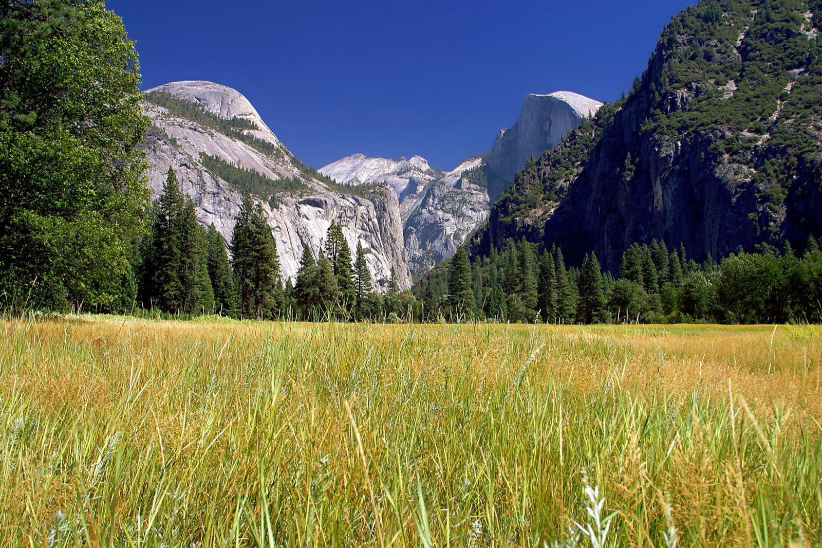
Half Dome and North Dome from a Yosemite Valley meadow in late summer Photo: Jon Sullivan, Public domain, via Wikimedia Commons (https://commons.wikimedia.org/wiki/File:Yosemite_meadows_2004-09-04.jpg) Day 5: Over the Tioga Pass to Death Valley
Yosemite Valley over the Tioga Road to Tuolumne Meadows and Lee Vining, Mono Lake, then south on US-395 by Lone Pine into Death Valley
- Drive about 6.5 h
- Breakfast, lunch and dinner
- Stay in Death Valley National Park
Day 5 details
This is the longest driving day of the trip, about 470 km and six and a half to seven hours at the wheel, because the slow, winding Tioga Road is the only Sierra crossing between here and the range's southern end. Six stops break it up, so no stretch is longer than about two hours. We leave at 7:30 am on the Tioga Road through Yosemite's high country: Olmsted Point for the back of Half Dome, the granite shore of Tenaya Lake, and a short walk at Tuolumne Meadows. The road tops out at the Tioga Pass, 3,031 m, and drops steeply to Lee Vining, where lunch is a sit-down stop before the tufa towers at Mono Lake's South Tufa. Then US-395 runs south under the eastern wall of the Sierra to Lone Pine and the Alabama Hills, with Mount Whitney above. From there the road drops into Death Valley by Father Crowley Vista. We reach Stovepipe Wells in the early evening and walk onto the Mesquite Flat Sand Dunes as the sun sets, then have dinner together.
Included
- Tioga Road with Olmsted Point, Tenaya Lake and Tuolumne Meadows
- Sit-down lunch in Lee Vining
- Mono Lake South Tufa
- The Alabama Hills below Mount Whitney
- Death Valley National Park entry
- Sunset on the Mesquite Flat Sand Dunes
- Dinner in Death Valley
Easier option: Stay by the vehicle at Olmsted Point and the Alabama Hills; at South Tufa, the first viewpoint is a short level walk.
More active option: Walk out to the highest dune at Mesquite Flat, about 3 km round trip on soft sand.
Activity: July and August: Death Valley's daytime highs are usually above 45 C, so on those departures we sleep in Mammoth Lakes instead (about 180 km and three hours from Yosemite) and cross Death Valley early on day 6. If the Tioga Road is still closed by snow, we go around the south end of the Sierra, a longer day, and tell you before you travel.
Day 6: Death Valley sunrise to Las Vegas
Stovepipe Wells to Zabriskie Point and Badwater Basin, then Furnace Creek and by Death Valley Junction and Pahrump to Las Vegas
- Drive about 4.5 h
- Breakfast
- Stay in Las Vegas
Day 6 details
Death Valley is best before the heat builds, so we start at sunrise at Zabriskie Point, where the first light runs across the folded yellow and brown badlands below the overlook. Then we drive south to Badwater Basin, 86 m below sea level and the lowest point in North America, and walk out onto the white salt flats while the morning is still cool. On the way back the Artists Drive loop passes coloured volcanic hillsides if time allows. We stop at the Furnace Creek visitor centre, then leave the park by Death Valley Junction and cross into Nevada through Pahrump. It is about 360 km and four and a quarter hours of driving, just over our usual mark, and the early start means we reach Las Vegas by mid-afternoon. Lunch is on your own today, so stop with the group in Pahrump or wait for the city. Our hotel is on or beside the Strip. The afternoon and evening are free: the Bellagio fountains and conservatory, a show, the old downtown on Fremont Street, or a pool after a week of early starts.
Included
- Sunrise at Zabriskie Point
- Badwater Basin salt flats with your guide
- Furnace Creek visitor centre
- Drop-off at our hotel on or beside the Las Vegas Strip
Optional experiences
- A Las Vegas show (extra, booked on request)
Easier option: Watch sunrise from the Zabriskie Point car park and walk only the first stretch of the Badwater salt flats.
Free time: Afternoon and evening free in Las Vegas
Activity: On July and August departures this day starts in Mammoth Lakes and crosses Death Valley in the morning, about 545 km and six and a half hours of driving, with short stops at the dunes and Zabriskie Point only and no Badwater detour.
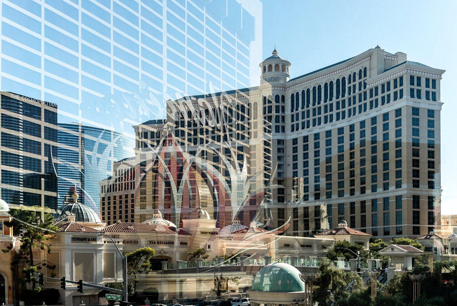
The Bellagio on the Las Vegas Strip Photo: Julian Lupyan, CC0, via Wikimedia Commons (https://commons.wikimedia.org/wiki/File:Reflection_of_the_Flamingo_Hotel_in_front_of_the_Bellagio.jpg) Day 7: Valley of Fire to Zion
Las Vegas north to Valley of Fire State Park, then Interstate 15 by St. George to Springdale at the gate of Zion
- Drive about 4 h
- Breakfast and lunch
- Stay in Springdale (Zion)
Day 7 details
We leave Las Vegas at 8:30 am for Valley of Fire, Nevada's oldest state park, an hour northeast, where red sandstone outcrops rise out of the Mojave. A short walk takes us to Mouse's Tank and the petroglyphs carved into the rock along the way, and we stop at Elephant Rock and the White Domes road for views over the coloured stone. Then we rejoin Interstate 15 through the Virgin River Gorge, where the highway threads a narrow canyon across a corner of Arizona into Utah. Clocks go forward an hour at the Utah line. Lunch is a sit-down stop in St. George. It is about 340 km and four hours of driving for the day, and we reach Springdale, the small town at Zion's south entrance, in the late afternoon. We stay two nights here in a hotel within walking distance of the park gate. Before dinner on your own we walk the paved Pa'rus Trail beside the Virgin River as the late sun turns the Watchman and the West Temple red.
Included
- Valley of Fire State Park: Mouse's Tank petroglyphs, Elephant Rock and the White Domes road
- Sit-down lunch in St. George
- Pa'rus Trail walk beside the Virgin River with your guide
Easier option: Stay near the vehicle at Elephant Rock and walk only the first part of the Mouse's Tank trail.
Free time: Evening free in Springdale
Activity: Valley of Fire is very hot in summer; we keep walks short and early.
Day 8: Zion Canyon and the Narrows
Springdale to the Temple of Sinawava by park shuttle, then Zion Lodge and back
- Breakfast and lunch
- Stay in Springdale (Zion)
Day 8 details
We ride one of the first park shuttles up the Zion Canyon Scenic Drive, which is closed to private cars for most of the year, and get off at the Temple of Sinawava at its end before the canyon fills. The paved Riverside Walk follows the Virgin River for about 1.8 km each way between walls that close in to a few dozen metres, past hanging gardens of ferns fed by seeps in the sandstone. Where the path ends, the Narrows begin. If the river is open (the park closes it at high flow and whenever flash floods are forecast), those who want to wade on up the riverbed in canyoneering boots with a walking stick, turning round at or before Orderville Canyon. Others take the shuttle back to Zion Lodge and follow the trail to the Lower Emerald Pool. We meet for a sit-down lunch at the lodge in the canyon. The afternoon and evening are free in Springdale: the Zion Human History Museum, a gallery, or a rest out of the midday heat after a long first week.
Included
- Zion National Park entry, including the non-resident surcharge where it applies
- Zion Canyon by park shuttle with your guide, on an early shuttle
- Riverside Walk to the mouth of the Narrows
- The Narrows to about Orderville Canyon, conditions permitting, with boots, neoprene socks and a walking stick included
- Sit-down lunch at the lodge in Zion Canyon
Optional experiences
- Horse ride along the Virgin River (extra, price shown at booking)
Easier option: Keep to the paved Riverside Walk and the short trail to the Lower Emerald Pool, both close to the shuttle stops.
More active option: Wade the Narrows for about three hours. If the river is closed, hike the West Rim Trail to Scout Lookout, about 6.4 km round trip and 330 m of climbing. Angels Landing beyond it needs a permit from the park's lottery, which we cannot promise.
Free time: Afternoon and evening free in Springdale
Activity: Wading the Narrows means cold water up to the knees or waist over slippery stones. The park decides each morning whether the river is open. On a two-night stay the river can be closed on both days; then the Riverside Walk and Emerald Pools, or Scout Lookout, are the plan.
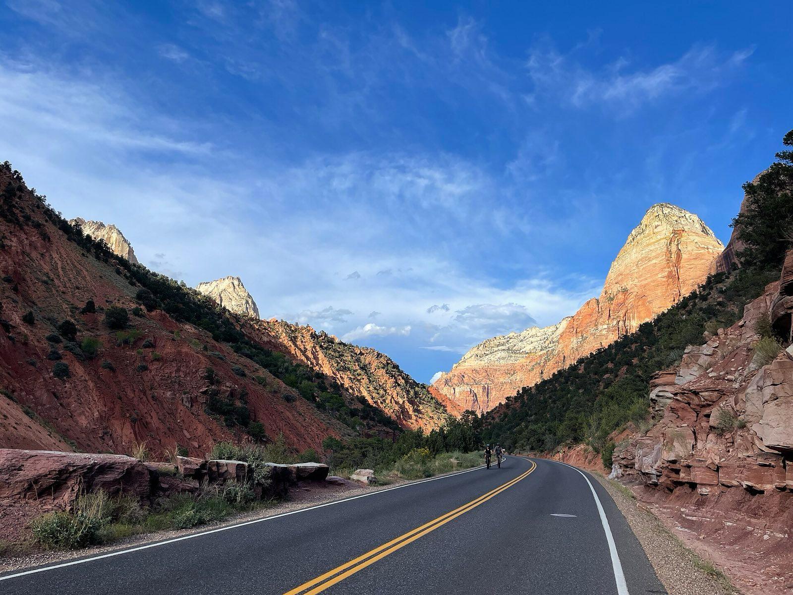
The Zion Canyon Scenic Drive, closed to private cars for most of the year Photo: Vulturesong, CC0, via Wikimedia Commons (https://commons.wikimedia.org/wiki/File:Zion_National_Park_-_HCP_-_October_02,_2022_-_014_-_Zion_Canyon_Scenic_Drive.jpg) Day 9: Over the Kaibab Plateau to the Grand Canyon
Springdale on the Zion to Mount Carmel Highway to Kanab, over the Kaibab Plateau by Jacob Lake to Marble Canyon, then Cameron and the Grand Canyon's Desert View Drive
- Drive about 6 h
- Breakfast and lunch
- Stay in Grand Canyon South Rim
Day 9 details
A long day, about 440 km and six hours of driving, because no road crosses the Grand Canyon: the only way round is by the Navajo Bridge. Five stops break it up. We leave at 8 am on the Zion to Mount Carmel Highway, which switchbacks up the canyon wall to a 1.8 km tunnel, and stop for the Canyon Overlook Trail, a 1.6 km round trip along ledges to a view over lower Zion Canyon. Then we drive by Kanab and over the forested Kaibab Plateau at Jacob Lake, down the Vermilion Cliffs to Marble Canyon, where the old Navajo Bridge lets you walk out 140 m above the Colorado River; California condors released nearby are sometimes seen here. Lunch is a sit-down stop at the historic trading post in Cameron. From there we climb to the East Entrance and the Desert View Watchtower, designed by Mary Colter, for our first look into the canyon. Arizona keeps standard time all year, so in summer the clock goes back an hour from Utah. We check in for two nights near Grand Canyon Village.
Included
- Canyon Overlook Trail on the Zion to Mount Carmel Highway
- The Navajo Bridge over the Colorado River at Marble Canyon
- Sit-down lunch at Cameron
- Grand Canyon National Park entry, including the non-resident surcharge where it applies
- Desert View Watchtower with your guide
Easier option: Skip the Canyon Overlook Trail, which has steps and drop-offs, and wait at the viewpoint by the tunnel.
Free time: Evening free after sunset at Mather Point, a short walk from the hotel
Activity: The Canyon Overlook car park is small; we aim to be there by about 8:30 am. Large vehicles need a ranger escort through the Mount Carmel tunnel, for a fee; we size our vehicle and book this ahead.
Day 10: A full day at the Grand Canyon
Grand Canyon Village, the South Kaibab Trail or the Rim Trail, and Hopi Point
- Breakfast and dinner
- Stay in Grand Canyon South Rim
Day 10 details
A full day at the canyon with no long drives. Sunrise from the rim is a short walk from the hotel for anyone who wants it. After breakfast the group splits by choice. The guide-led hike takes the park shuttle to the South Kaibab trailhead and goes below the rim to Ooh Aah Point, about 2.9 km round trip with 180 m down and back up; hiking here is a mountain climb in reverse, so we start early while it is cool. The easier group walks the level Rim Trail from the Yavapai Geology Museum along the Trail of Time, where the rocks beside the path are laid out by age across nearly two billion years. We meet in Grand Canyon Village around midday among the historic buildings: Hopi House, Verkamp's and the El Tovar hotel. Lunch and the afternoon are free, for the Kolb Studio on the rim, a ranger talk or a rest. Late in the day the Hermit Road shuttle takes us west to Hopi Point, where the canyon opens wide for sunset, followed by dinner together.
Included
- Guide-led hike on the South Kaibab Trail to Ooh Aah Point
- Rim Trail and the Trail of Time from the Yavapai Geology Museum
- Grand Canyon Village: Hopi House, Verkamp's and the El Tovar
- Sunset at Hopi Point by the Hermit Road shuttle
- Dinner together
Optional experiences
- Helicopter flight over the canyon from Tusayan (extra, price shown at booking)
Easier option: Walk the level, paved Rim Trail and the Trail of Time only, with benches and shuttle stops along the way.
More active option: Continue past Ooh Aah Point to Cedar Ridge, about 4.8 km round trip with about 350 m to climb back out.
Free time: Lunch and the afternoon free in Grand Canyon Village
Activity: The South Rim is at about 2,100 m. Do not try to hike to the river and back in a day; the park warns against it.
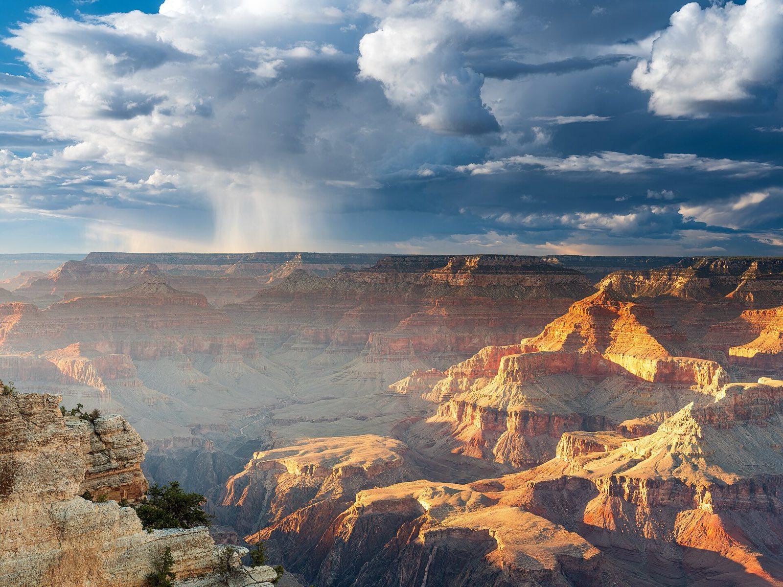
A passing summer storm over the Grand Canyon in the late light Photo: Romain Guy from San Francisco, USA, CC0, via Wikimedia Commons (https://commons.wikimedia.org/wiki/File:Rain_over_Grand_Canyon.jpg) Day 11: Route 66 and the Mojave to Joshua Tree
Grand Canyon South Rim to Williams, Seligman and Kingman, then west on Interstate 40 into California, Amboy and Twentynine Palms
- Drive about 6 h
- Breakfast, lunch and dinner
- Stay in Twentynine Palms (Joshua Tree)
Day 11 details
The longest drive of the trip, about 590 km and six hours of driving, eight and a half to nine hours with the stops. We chose one long day across the desert over a third one-night stop, so the parks and cities on either side keep two nights each. Six stops break it up, so no stretch is longer than about an hour and a half. We leave the rim at 7 am for coffee in Williams, then Seligman, a small town on a surviving stretch of old Route 66 with vintage cars and neon signs. Lunch is a sit-down stop in Kingman, by the Route 66 museum in the old powerhouse. Then Interstate 40 crosses the Colorado River into California at Needles, and we turn south across the Mojave to Amboy, a near-empty Route 66 town known for the sign of Roy's Motel and Cafe, with Amboy Crater on the horizon. We reach Twentynine Palms, at the north gate of Joshua Tree National Park, by about 4:30 pm. After dinner together, Joshua Tree's dark skies are a short drive away.
Included
- Route 66 in Williams and Seligman
- Sit-down lunch in Kingman and the Route 66 museum
- Amboy and Roy's Motel and Cafe on Route 66 in California
- Dinner in Twentynine Palms
- Stargazing in Joshua Tree with your guide, skies permitting
Activity: On this day Arizona and California show the same time from spring to autumn. The Mojave is very hot in summer; stops are short and the vehicle is air-conditioned.
Day 12: Joshua Tree to Santa Monica
Twentynine Palms through Joshua Tree National Park to Keys View and the West Entrance, then west to Santa Monica
- Drive about 4.5 h
- Breakfast and lunch
- Stay in Santa Monica (Los Angeles)
Day 12 details
We are in Joshua Tree National Park early, when the boulder piles glow and the air is still cool. The park sits where two deserts meet, the low Colorado and the higher Mojave, and the shaggy Joshua trees grow only in the higher, western part. We stop at Skull Rock, then walk the Hidden Valley Nature Trail, a 1.6 km loop through a ring of granite boulders said to have hidden stolen cattle, and drive up to Keys View, about 1,580 m up, for the view over the Coachella Valley to the San Andreas Fault and, on clear days, the Salton Sea. We leave by the West Entrance for a sit-down lunch in the town of Joshua Tree, then drive west past the wind turbines of the San Gorgonio Pass and into Los Angeles. It is about 380 km and four and a half hours of driving, more if Los Angeles traffic is heavy. We check in for two nights in Santa Monica by late afternoon and walk to the pier, where a sign marks the end of Route 66, to watch the sun go down over the Pacific.
Included
- Joshua Tree National Park entry
- Skull Rock and the Hidden Valley Nature Trail with your guide
- Keys View
- Sit-down lunch in Joshua Tree
- Santa Monica Pier and the end of Route 66 at sunset
Easier option: Stay at Skull Rock and Keys View, both close to the road, and skip the Hidden Valley loop.
More active option: Add the Barker Dam loop, about 1.8 km, for the old rock-lined reservoir and petroglyphs nearby.
Free time: Evening free in Santa Monica
Day 13: Griffith Observatory, Hollywood and Santa Monica
Santa Monica to Griffith Observatory, Hollywood Boulevard and the Original Farmers Market, then back to Santa Monica
- Drive about 2 h
- Breakfast, lunch and dinner
- Stay in Santa Monica (Los Angeles)
Day 13 details
Our last full day starts on the hill at Griffith Observatory, with the Hollywood Sign on the ridge to the north and the basin of Los Angeles laid out to the Pacific. The grounds and terraces are free and open early; the building itself opens at noon on weekdays and is closed on Mondays, so the guide fits the visit to the day of the week. Then we drive down to Hollywood Boulevard to walk a stretch of the Walk of Fame past the TCL Chinese Theatre and the Dolby Theatre, home of the Academy Awards. Lunch is at the Original Farmers Market on Fairfax Avenue, a market of food stalls running since 1934, where everyone picks their own. In the afternoon the vehicle takes anyone who wants it to the Getty Center, free to enter, for the gardens and the views from the hilltop, or back to Santa Monica for the beach. It is about 70 km of city driving and about two hours. We finish with a farewell dinner together in Santa Monica.
Included
- Griffith Observatory grounds and the view of the Hollywood Sign with your guide
- Hollywood Walk of Fame, the TCL Chinese Theatre and the Dolby Theatre
- Lunch at the Original Farmers Market on Fairfax Avenue
- The Getty Center by our vehicle, for those who want it
- Farewell dinner in Santa Monica
Easier option: Stay on the observatory terrace and take the vehicle straight back to Santa Monica after lunch.
Free time: Afternoon free in Santa Monica or at the Getty Center
Activity: The Getty Center is closed on Mondays; on a Monday we offer the Santa Monica beach path or the Venice canals instead.
Day 14: Santa Monica and home
Santa Monica to Los Angeles International Airport (LAX)
- Drive about 45 min
- Breakfast
Day 14 details
A slow last morning by the sea after two weeks on the road. Walk or cycle the beach path south from the pier to the Venice boardwalk and the canals, about 4 km each way, or have a long breakfast and pack. Airport transfers to Los Angeles International Airport (LAX), about 15 km south, leave the hotel in set windows through the morning; the drive takes 30 to 45 minutes depending on traffic, so we send your time with your final itinerary. If you are staying on in Los Angeles, we can book extra nights at the same hotel. Your See Sight Tours guide says goodbye at the hotel. Book a flight leaving after about 1:30 pm, and allow for the airport's long security lines in summer. If you fly out of a different airport, such as Burbank or Long Beach, tell us when you book so we can quote the transfer. By then the loop has covered about 2,900 km of road from San Francisco, across four states and five national parks.
Included
- Drop-off at Los Angeles International Airport (LAX)
Free time: Morning free in Santa Monica
Activity: Book a flight leaving Los Angeles after about 1:30 pm.
Wildlife and weather: San Francisco is often foggy and 15 to 20 C in summer. Yosemite's falls are fullest in June and low by September. Death Valley, Las Vegas and the Mojave regularly pass 40 C from June to September and Death Valley's July and August highs are usually above 45 C, which is why those departures sleep in Mammoth Lakes instead. July to September brings afternoon thunderstorms to Zion and the Grand Canyon that can close the Narrows. Mule deer are common in Yosemite and Zion, elk graze around Grand Canyon Village, and California condors are sometimes seen at Navajo Bridge and along the South Rim.
13 nights
Where you'll stay
Your hotels are named in your trip confirmation.
- San Francisco2 nights
- Yosemite National Park2 nights
- Death Valley National Park1 night
- Las Vegas1 night
- Springdale (Zion)2 nights
- Grand Canyon South Rim2 nights
- Twentynine Palms (Joshua Tree)1 night
- Santa Monica (Los Angeles)2 nights
One price
What's in the price
Included
Accommodation
- 13 nights in 3-star-plus hotels: 2 in central San Francisco, 2 in Yosemite Valley or at El Portal, 1 in Death Valley (Mammoth Lakes in July and August), 1 on or beside the Las Vegas Strip, 2 in Springdale at the Zion gate, 2 at the Grand Canyon South Rim, 1 in Twentynine Palms by Joshua Tree, 2 in Santa Monica
- Rooms shared, or your own for a supplement
Transport
- Pick-up at San Francisco International Airport (SFO) and drop-off at Los Angeles International Airport (LAX)
- A private vehicle and professional driver for the group, sized so 12 guests have spare seats
- Powell and Hyde cable car and the Alcatraz ferry in San Francisco
- Park shuttles in Zion and on Hermit Road at the Grand Canyon
Your guide
- A See Sight Tours guide for the whole trip, from San Francisco to Los Angeles
Activities
- Entry to Yosemite, Death Valley, Zion, Grand Canyon and Joshua Tree National Parks, including the non-resident surcharge where it applies
- San Francisco: Golden Gate Bridge walk, cable car, Alcatraz with the cell house audio tour
- Yosemite: Tunnel View, Bridalveil Fall, Lower Yosemite Fall, the Mist Trail or Cook's Meadow, Glacier Point at sunset
- Tioga Road, Mono Lake South Tufa and the Alabama Hills
- Death Valley: Mesquite Flat dunes, Zabriskie Point, Badwater Basin
- Valley of Fire State Park entry
- Zion: Pa'rus Trail, Riverside Walk and the Narrows with boots, socks and stick, Canyon Overlook Trail
- Navajo Bridge, Desert View Watchtower, guide-led South Kaibab hike, Trail of Time, Hopi Point sunset
- Route 66 in Williams, Seligman, Kingman and Amboy
- Joshua Tree: Skull Rock, Hidden Valley, Keys View, stargazing
- Los Angeles: Griffith Observatory grounds, Hollywood Walk of Fame, Santa Monica Pier
Meals
- 13 breakfasts
- 10 lunches (days 2 to 5, 7 to 9 and 11 to 13), including a Yosemite picnic
- 5 dinners: welcome in San Francisco, Death Valley, the Grand Canyon, Twentynine Palms and a farewell dinner in Santa Monica
Not included
- International flights to San Francisco and from Los Angeles
- ESTA or US visa
- Travel insurance
- Meals not listed: lunch on days 1, 6, 10 and 14, dinners on days 2, 3, 4, 6, 7, 8, 9, 12 and 14
- Drinks
- Tips for your guide and driver
- Optional activities, such as a Las Vegas show, a Grand Canyon helicopter flight or a horse ride in Zion
- Griffith Observatory planetarium shows and Getty Center parking or exhibitions with a charge
- An Angels Landing permit
- Extra nights before or after the trip
- Personal expenses
Extras
- Room of your own
- CAD 1,490 (estimated price)

See Sight Tours has been providing travel services across North America since 2006. Operating in 20 cities across Canada and the USA, the company specializes in small group tours that offer personalized, high-quality experiences for travelers.


Book your Tour
Get in Touch
- Toll Free1-888-961-6584
- Local1-289-271-9767


© 2026 See Sight Tours. All rights reserved.