Printable itinerary
New Zealand active: Tongariro Crossing, Abel Tasman and Queenstown
12 days · Auckland to Queenstown · up to 12 guests
From CAD 6,325 per person, sharing a room (estimated price. Estimated price. The itinerary, hotels and availability are proposed and subject to confirmation. Your quote will set out the booking conditions; sending a request does not confirm a booking.)
Day by day
Itinerary
The longest drive is 4 h, on day 4.
- Aucklandstart
- Rotorua1 night
- National Park Village2 nights
- Wellington1 night
- Kaiteriteri2 nights
- Punakaiki1 night
- Franz Josef1 night
- Wanaka1 night
- Queenstown2 nights
- Overnight stop
- Day trip
- By boat or train
Day 1: Arrive in Auckland, on to Rotorua
Auckland Airport to Rotorua
- Drive about 3 h
- Welcome dinner
- Stay in Rotorua
Day 1 details
Most flights from North America land at Auckland Airport (AKL) early in the morning, and your See Sight Tours guide and driver meet you in the arrivals hall. Plan to land by about 10 am; the latest arrival time is confirmed with your final itinerary. We skip the city and drive about three hours south through the green dairy country of the Waikato, with a coffee stop on the way, to Rotorua on the shore of its lake. After check-in there is time to rest. In the late afternoon we take an easy walk through Kuirau Park, a free public park in the middle of town where mud pools bubble and steam drifts out of fenced craters, then along the lakefront to the Government Gardens. In the evening the group meets for a short briefing on the walks ahead: what to pack for the Tongariro Alpine Crossing, how the fallback plans work and how the days are paced. Then we sit down together for a welcome dinner. If a long-haul flight leaves you tired, we can book a pre-trip night in Auckland so you arrive rested.
Included
- Pick-up at Auckland Airport (AKL)
- Kuirau Park geothermal walk and the Government Gardens with your guide
- Welcome briefing
- Welcome dinner
Optional experiences
- A soak in Rotorua's lakeside hot pools (price shown at booking)
Free time: Free afternoon after check-in
Day 2: Redwoods by bike, then south to Tongariro
Rotorua to Whakarewarewa Forest, then Huka Falls, Taupō and National Park Village
- Drive about 3 h
- Breakfast and lunch
- Stay in National Park Village
Day 2 details
After breakfast we ride in Whakarewarewa Forest on the edge of Rotorua, where Californian redwoods planted from 1901 now stand over a large network of graded mountain bike trails. A local bike guide fits you with a bike and helmet and leads a ride of about two hours on the wider, easier trails through the redwoods and tree ferns, with an e-bike for anyone who wants help on the climbs. Then we drive south, about 200 km and under three hours in all. We stop at Huka Falls, where the Waikato River is forced through a narrow rock channel and pours out bright blue, and sit down to lunch in Taupō beside the lake. The road follows the eastern shore of Lake Taupō, then climbs onto the volcanic plateau. By late afternoon we reach National Park Village, below Mount Ruapehu, where we stay two nights. Your guide checks the mountain forecast and briefs the group on tomorrow's crossing before dinner.
Included
- Guided mountain bike ride in Whakarewarewa Forest (the Redwoods), bike and helmet hire, e-bike on request
- Huka Falls
- Sit-down lunch in Taupō
- Crossing briefing with your guide
Easier option: Walk instead of riding: the flat Redwoods Memorial Grove loop through the tallest trees, about 30 minutes.
More active option: Ride a longer, more technical trail loop with the bike guide.
Free time: Evening free in National Park Village
Activity: About two hours on the bike on wide gravel trails; no mountain biking experience needed.
Day 3: The Tongariro Alpine Crossing
Mangatepopo road end over Red Crater to Ketetahi, back to National Park Village
- Drive about 45 min
- Breakfast and lunch
- Stay in National Park Village
Day 3 details
A shuttle collects the group at about 6:30 am for the short drive to the Mangatepopo road end. Starting early matters: the walk takes most of the day and cloud often builds in the afternoon. With a local mountain guide (from an operator authorised by DOC, confirmed at booking) and your See Sight Tours guide, you walk 19.4 km across Tongariro National Park, New Zealand's first national park and a World Heritage Area listed for both its volcanoes and its meaning to Māori. The track follows the tussock of the Mangatepopo Valley, climbs the Devil's Staircase to South Crater, then rises to the rim of Red Crater, the high point at 1,886 m. From there it drops on loose scree to the Emerald Lakes and passes Blue Lake before the long descent through tussock and then forest to the Ketetahi road end, where the shuttle waits. Lunch is carried and eaten on the track, with Mount Ngauruhoe beside you. If the forecast closes the alpine section, we walk to Taranaki Falls and ride the Sky Waka gondola on Mount Ruapehu instead.
Included
- Shuttle to the Mangatepopo road end and back from Ketetahi
- The Tongariro Alpine Crossing with a local mountain guide and your See Sight Tours guide
- Carried trail lunch
- Weather fallback: Taranaki Falls walk and the Sky Waka gondola on Mount Ruapehu
Easier option: Skip the crossing: walk the Taranaki Falls loop from Whakapapa Village (about 6 km, 2 hours) and ride the Sky Waka gondola up Mount Ruapehu with a second guide or your driver.
Free time: Evening free to rest
Activity: 19.4 km, 7 to 8 hours, about 760 m of climbing and 1,100 m of descent, some of it on loose scree. Out of respect for local iwi we do not climb the summits of Ngauruhoe or Tongariro. The guide decides on the day if the weather is safe.
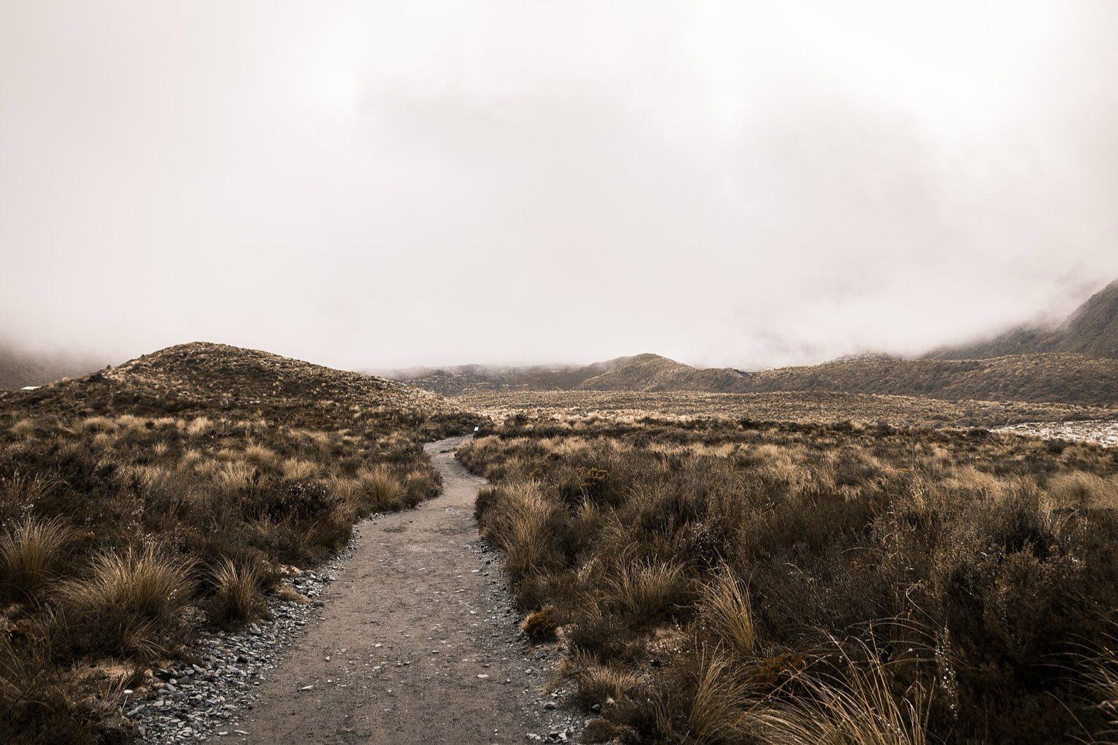
Tussock and low cloud on the Tongariro Alpine Crossing Photo: Daniel Chen d_che, CC0, via Wikimedia Commons (https://commons.wikimedia.org/wiki/File:Tongariro_Alpine_Crossing,_Tongariro_National_Park,_New_Zealand_(Unsplash_KI0g45putx8).jpg) Day 4: Down the Desert Road to Wellington
National Park Village to Wellington by the Desert Road
- Drive about 4 h
- Breakfast and lunch
- Stay in Wellington
Day 4 details
A slower start after yesterday. We leave National Park Village mid-morning and drive about four hours and 330 km to Wellington, the longest North Island drive of the trip, broken by a coffee stop and a sit-down lunch on the way. The road runs round Mount Ruapehu and down the Desert Road, a high, bare plateau of tussock and pumice with the three volcanoes behind you on a clear day, then through the farmland of the Rangitīkei and down the coast to the capital. We reach Wellington in the middle of the afternoon. Your guide walks the group along the waterfront to Te Papa, the national museum (entry included), for an hour or two in the galleries on New Zealand's land, its natural history and its Māori collections. The evening is free in the central city, which is compact and easy to walk, with a long harbourside promenade and plenty of places to eat.
Included
- Drive down the Desert Road with your guide
- Sit-down lunch on the way
- Te Papa, the national museum, with your guide (entry included)
Optional experiences
- The Wellington Cable Car to Kelburn and a walk down through the Botanic Garden (fare shown at booking)
Free time: Evening free in central Wellington
Day 5: The ferry across Cook Strait to Abel Tasman
Wellington to Picton by ferry, then by road to Kaiteriteri
- Drive about 2.5 h
- Breakfast
- Stay in Kaiteriteri
Day 5 details
We take a morning sailing across Cook Strait, about three and a half hours on the Interislander or Bluebridge ferry, confirmed with your dates. Once out of Wellington Harbour the strait can be lively, then the ferry turns into Tory Channel and runs the length of Queen Charlotte Sound, a drowned valley of steep, bush-covered ridges, to Picton. From Picton we drive about two and a half hours and 170 km west, over the hills to Havelock, through Nelson and along Tasman Bay to Kaiteriteri, on the southern edge of Abel Tasman National Park, where we stay two nights. Lunch is your choice on board or in Picton, depending on the sailing time. We arrive in the late afternoon, with time for a swim from Kaiteriteri's golden beach or a walk on the headland track before dinner. Tonight your guide checks the tide tables, because the water taxis and the coast track both work around them.
Included
- Cook Strait ferry from Wellington to Picton
- Drive from Picton to Kaiteriteri with your guide
Free time: Late afternoon and evening free in Kaiteriteri
Day 6: Water taxi and the Abel Tasman Coast Track
Kaiteriteri by water taxi to Anchorage, then on foot to Marahau
- Drive about 15 min
- Breakfast and lunch
- Stay in Kaiteriteri
Day 6 details
A water taxi carries the group north from Kaiteriteri along the coast of Abel Tasman National Park, past Split Apple Rock, and lands us on the beach at Anchorage. From there we walk the Abel Tasman Coast Track, one of New Zealand's Great Walks, back south to Marahau: about 12.4 km and four hours on a wide, well-graded path that climbs over headlands and drops into bays of golden sand and clear green water. Short side tracks lead down to Te Pukatea Bay and out to Stillwell Bay and Apple Tree Bay, and there is time to swim. We stop for a picnic lunch on a beach, carried from Kaiteriteri. The forest along the track is regenerating native bush, with tree ferns and the calls of tūī and bellbirds, and shags and oystercatchers work the sand at low tide. At Marahau the van takes us back to Kaiteriteri for a free evening.
Included
- Water taxi from Kaiteriteri to Anchorage
- Abel Tasman Coast Track walk from Anchorage to Marahau with your guide
- Picnic lunch on the track
Easier option: Walk only the Anchorage end: the Pitt Head loop and Te Pukatea Bay (about an hour), then a beach afternoon and the water taxi back from Anchorage.
More active option: Add the side trip from Torrent Bay up to Cleopatra's Pool, a rock pool and natural water slide on the Torrent River, about two extra hours (tide permitting).
Free time: Evening free in Kaiteriteri
Activity: About 12.4 km and 4 hours of walking on a well-made track with short climbs over headlands.
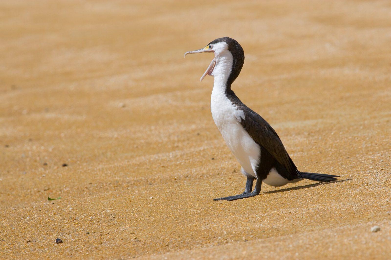
A pied shag on the sand at Te Pukatea Bay, Abel Tasman National Park Photo: Christian Mehlführer, User:Chmehl, CC BY 2.5, via Wikimedia Commons (https://commons.wikimedia.org/wiki/File:PiedCormorant_MC.jpg) Day 7: A kayak morning, then the Buller Gorge to Punakaiki
Marahau by sea kayak, then Motueka, Murchison, the Buller Gorge and Westport to Punakaiki
- Drive about 4 h
- Breakfast, lunch and dinner
- Stay in Punakaiki
Day 7 details
An early start on the water: a guided half-day sea kayak trip from Marahau along the southern coast of the park, in stable double kayaks, with a local kayak guide who briefs everyone on the beach first. We paddle around rocky islets and sheltered coves, where New Zealand fur seals often haul out and shags dive for fish, and land on a beach for a break. We are off the water by about midday. After a sit-down lunch in Motueka we head for the West Coast, about four hours and 270 km of driving: up the Motueka Valley past orchards and hop gardens to Murchison, then down the Buller Gorge, where the river cuts through steep forest, to Westport and south along the coast road. We reach Punakaiki in the early evening and walk out to the Pancake Rocks at Dolomite Point, layered limestone stacks where, at high tide with a westerly swell, the sea booms up through the blowholes. Dinner is together tonight, because Punakaiki has few places to eat.
Included
- Guided half-day sea kayak trip from Marahau
- Sit-down lunch in Motueka
- The Pancake Rocks and blowholes at Punakaiki with your guide
- Dinner in Punakaiki
Easier option: Skip the paddle: a slow morning at Kaiteriteri beach and the headland walk, and join the group for lunch.
Activity: About 3 hours in a double kayak on sheltered water; no experience needed. The kayak trip runs only in safe sea conditions; if it is cancelled we walk another section of the coast track instead.
Golden sand on the Abel Tasman coast, where the kayak trip lands for a break Photo: Atlas Green atlas_green, CC0, via Wikimedia Commons (https://commons.wikimedia.org/wiki/File:Abel_Tasman_National_Park_(Unsplash).jpg) Day 8: Hokitika and the Franz Josef glacier valley
Punakaiki to Greymouth and Hokitika, then Franz Josef
- Drive about 3 h
- Breakfast
- Stay in Franz Josef
Day 8 details
Before breakfast, walk back to the Pancake Rocks if the tide suits, or take the Pororari River track, an easy hour into a limestone gorge of nīkau palms and dense rainforest in Paparoa National Park. Then we drive south down the West Coast, about three hours and 220 km in all, through Greymouth to Hokitika, a gold-rush town on a driftwood beach, where there is time for lunch of your choice and a look into the pounamu (greenstone) carving workshops. The road continues south between the Tasman Sea and the Southern Alps to Franz Josef. In the late afternoon, when the day visitors have gone, we walk up the Waiho River valley on the Franz Josef Glacier walk, about 5.4 km return and an hour and a half, across a riverbed of grey boulders between walls of rainforest and bare rock to a viewpoint below the ice. The glacier has retreated a long way in recent decades, and your guide explains what has changed. The evening is free.
Included
- Pororari River track in Paparoa National Park
- Hokitika beach and town
- Franz Josef Glacier valley walk with your guide
Optional experiences
- Glacier helicopter flight with a snow landing, weather permitting (price shown at booking, paid only once the flight is confirmed to go)
Easier option: Stop at the Sentinel Rock lookout, a 20-minute walk, instead of the full valley walk.
More active option: Add the Tatare Tunnels walk, about 1.5 hours through old water-race tunnels with a headlamp and wet feet.
Free time: Evening free in Franz Josef
Activity: The glacier valley track closes after heavy rain; the guide checks it on the day.
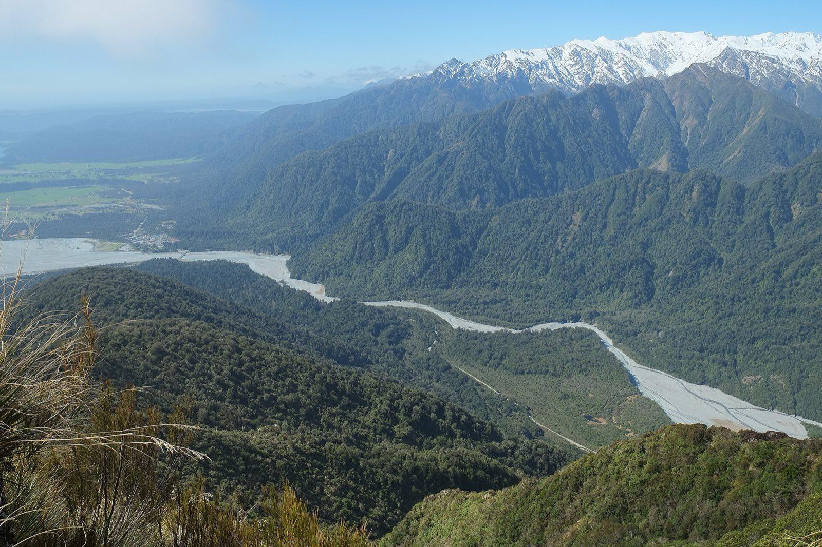
Franz Josef and the Waiho River valley, seen from Alex Knob Photo: Pseudopanax at English Wikipedia, Public domain, via Wikimedia Commons (https://commons.wikimedia.org/wiki/File:Franz_Josef_village_and_valley_from_Alex_Knob.jpg) Day 9: Over the Haast Pass to Wanaka
Franz Josef to Knights Point, Haast and the Haast Pass, then Wanaka
- Drive about 4 h
- Breakfast and lunch
- Stay in Wanaka
Day 9 details
We leave Franz Josef after breakfast for the drive to Wanaka, about four hours and 285 km, broken by short walks and a sit-down lunch. The road runs south past Fox Glacier and Lake Paringa to the coast at Knights Point, where a lookout faces the Tasman Sea, then to Ship Creek, with boardwalks through swamp forest and onto a wild beach. From the Haast River the highway climbs to the Haast Pass, at 563 m, inside Mount Aspiring National Park. We stop at Thunder Creek Falls and Fantail Falls, and walk the short forest track to the Blue Pools, where glacier-fed water runs clear blue under a swing bridge. Lunch is at Haast or Makarora, depending on the weather and the time. Past the pass the rainforest gives way to the dry, tawny hills of Central Otago, and the road follows the shores of Lake Wānaka and Lake Hāwea to the town. You reach Wanaka by late afternoon, with a free evening on the lakefront.
Included
- Knights Point lookout and the Ship Creek walks
- The Haast Pass, Thunder Creek Falls and Fantail Falls
- The Blue Pools walk
- Sit-down lunch on the way
Free time: Evening free in Wanaka
Activity: Short walks only today, the longest about 1.5 km return to the Blue Pools.
Day 10: Roys Peak or Mount Iron, then Queenstown
Wanaka to the Roys Peak road end, then over the Crown Range to Queenstown
- Drive about 1.5 h
- Breakfast and lunch
- Stay in Queenstown
Day 10 details
We start at about 7 am for Roys Peak, while it is cool and before the small car park fills. From the road end beside Lake Wānaka the track climbs steadily through farmland and tussock to the ridge and on to the summit at 1,578 m: 16 km return, about 1,250 m of climbing and five to six hours on a wide, steep track with no shade. The view takes in Lake Wānaka, its islands and, on a clear day, Mount Aspiring. Lunch is carried and eaten near the top. If you prefer something shorter, the Mount Iron loop on the edge of town is about 4.5 km and an hour and a half, with views over the lake and the Clutha River, and the rest of the morning is free in Wanaka. If Roys Peak is closed or in cloud, the group walks Diamond Lake and Rocky Mountain instead. In the middle of the afternoon we drive over the Crown Range to Queenstown, about an hour, where we stay two nights. The evening is free.
Included
- Roys Peak Track with your guide, or Diamond Lake and Rocky Mountain when Roys Peak is closed or in cloud
- Carried trail lunch
- Drive over the Crown Range to Queenstown
Easier option: The Mount Iron loop (about 4.5 km, 1.5 hours) and a free morning in Wanaka.
More active option: Roys Peak to the summit (16 km return, about 1,250 m of climbing).
Free time: Evening free in Queenstown
Activity: Roys Peak Track closes for lambing from 1 October to 10 November each year, so our departures start after it reopens.
Day 11: A day on the Routeburn Track
Queenstown to Glenorchy and the Routeburn Shelter, then the Routeburn Track and back
- Drive about 2.5 h
- Breakfast, lunch and dinner
- Stay in Queenstown
Day 11 details
Today is a day walk on the Routeburn Track, one of New Zealand's Great Walks, inside the Te Wāhipounamu World Heritage Area. We drive about an hour and a quarter along Lake Wakatipu to Glenorchy and on up the valley road to the Routeburn Shelter. From there the track climbs gently through red and silver beech forest, crosses swing bridges over the clear water of the Route Burn and opens onto the grassy Routeburn Flats under the mountains. The full walk carries on up a steeper section to the Routeburn Falls Hut at the bushline, where the falls tumble down beside the hut and the view opens back down the valley: about 18 to 19 km return and six to seven hours. The easier walk turns at the Flats, about 15 km return on gentle track. We carry a picnic lunch and eat it by the river or at the hut. On the way back we stop in Glenorchy, then return to Queenstown for a farewell dinner together.
Included
- Return transport to the Routeburn Shelter
- Routeburn Track day walk with your guide
- Picnic lunch on the track
- Glenorchy
- Farewell dinner in Queenstown
Easier option: Turn at the Routeburn Flats: about 15 km return on gentle track.
More active option: Continue to the Routeburn Falls Hut: about 18 to 19 km return and 6 to 7 hours.
Activity: Mostly well-made track through forest; the last section to the Falls Hut is steeper and rocky.
Day 12: Queenstown and home
Queenstown to Queenstown Airport
- Drive about 15 min
- Breakfast
Day 12 details
Your last morning is free. Ride the Skyline Gondola up Bob's Peak for the view over Lake Wakatipu and the Remarkables, walk the lakefront and the Queenstown Gardens on their peninsula, or sit with a coffee by the wharf. If you have longer, a jet boat on the Shotover River or a short trip to the gold-rush town of Arrowtown can fit into the morning, and your guide helps you book. We transfer the group to Queenstown Airport (ZQN), about 8 km and fifteen minutes from the centre, at a time set to the group's flights. Most journeys home connect through Auckland, Christchurch or Sydney, so book a flight leaving after about 11 am. If you would rather stay on, Milford Sound is a day trip from Queenstown, and we can book an extra night and the trip for you. Your guide sees you to the airport and checks your flight before saying goodbye.
Included
- Drop-off at Queenstown Airport (ZQN)
Optional experiences
- Skyline Gondola, Shotover River jet boat, Arrowtown (prices shown at booking)
Free time: Morning free in Queenstown
Activity: Book a flight leaving after about 11 am.
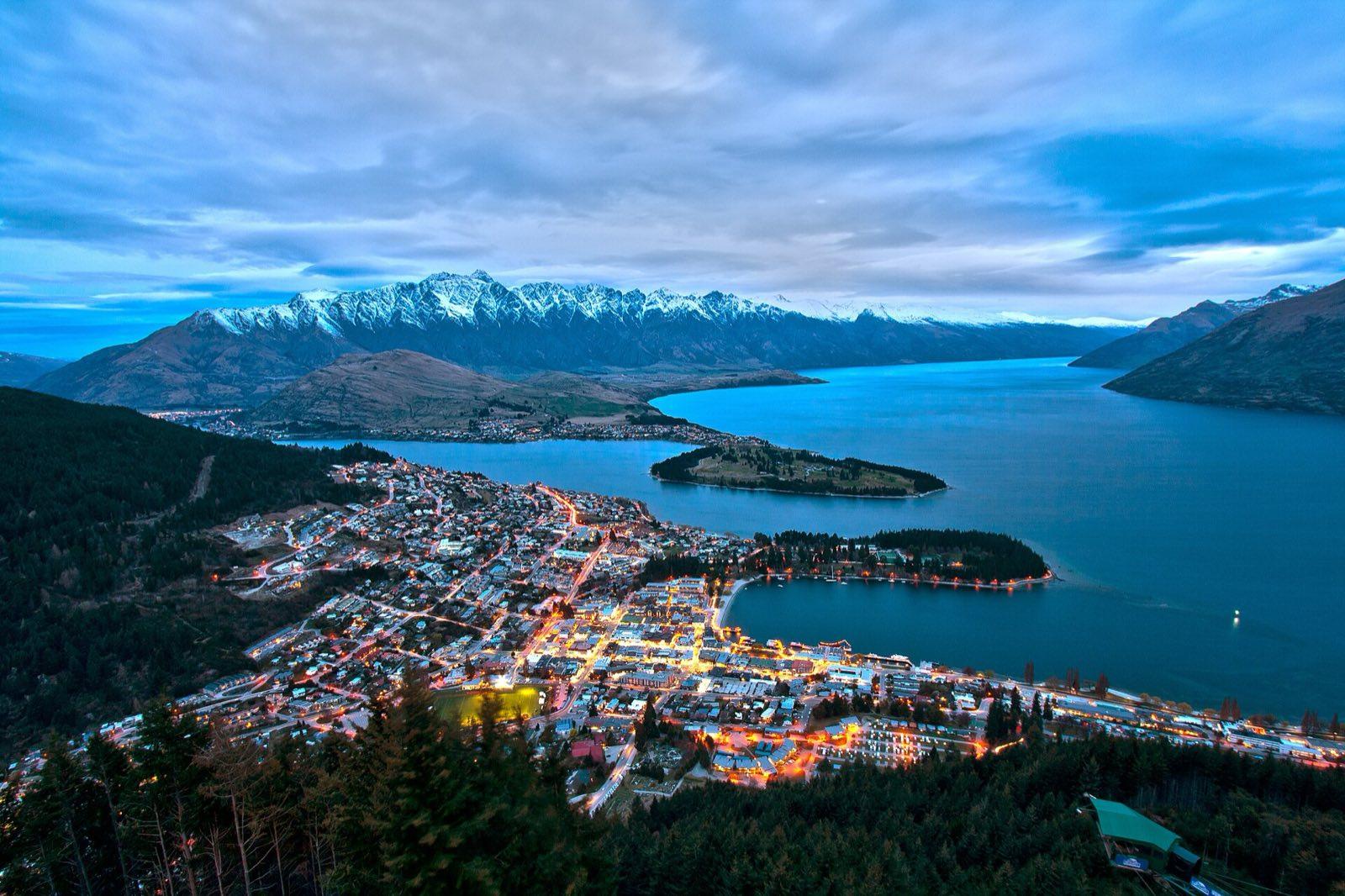
Queenstown and Lake Wakatipu from Bob's Peak Photo: Lawrence Murray from Perth, Australia, CC BY 2.0, via Wikimedia Commons (https://commons.wikimedia.org/wiki/File:Queenstown_from_Bob%27s_Peak.jpg)
Wildlife and weather: November to April is the walking season: long days, warm valleys and alpine sections usually clear of snow, though early November can still bring snow at Red Crater and summer brings sandflies to the coast. Rain is common on the West Coast in any month.
11 nights
Where you'll stay
Your hotels are named in your trip confirmation.
- Rotorua1 night
- National Park Village2 nights
- Wellington1 night
- Kaiteriteri2 nights
- Punakaiki1 night
- Franz Josef1 night
- Wanaka1 night
- Queenstown2 nights
One price
What's in the price
Included
Accommodation
- 11 nights in central 3-star-plus hotels with private bathrooms: 1 in Rotorua, 2 in National Park Village (Tongariro), 1 in Wellington, 2 in Kaiteriteri (Abel Tasman), 1 in Punakaiki, 1 in Franz Josef, 1 in Wanaka, 2 in Queenstown
- Rooms shared, or your own for a supplement
Transport
- Pick-up at Auckland Airport (AKL) and drop-off at Queenstown Airport (ZQN)
- Our own vehicle and driver for the group throughout
- Tongariro Alpine Crossing shuttles to Mangatepopo and from Ketetahi
- Cook Strait ferry from Wellington to Picton
- Abel Tasman water taxi from Kaiteriteri to Anchorage
- Return transport to the Routeburn Track
Your guide
- A See Sight Tours guide for the whole trip
- A local mountain guide on the Tongariro Alpine Crossing (operator confirmed at booking)
- Local guides for the bike ride and the sea kayak trip
Activities
- Kuirau Park and the Government Gardens, Rotorua
- Guided mountain bike ride in Whakarewarewa Forest (the Redwoods), with bike hire
- Huka Falls
- The Tongariro Alpine Crossing, or Taranaki Falls and the Sky Waka gondola if the weather closes it
- Te Papa entry, Wellington
- Abel Tasman Coast Track walk, Anchorage to Marahau
- Guided half-day sea kayak trip, Abel Tasman
- The Pancake Rocks and the Pororari River track, Punakaiki
- Hokitika
- Franz Josef Glacier valley walk
- Knights Point, Ship Creek, the Haast Pass and the Blue Pools
- Roys Peak, Mount Iron or Diamond Lake, Wanaka
- Routeburn Track day walk and Glenorchy
Meals
- Breakfast daily (11)
- 8 lunches: sit-down lunches on days 2, 4, 7 and 9, carried trail lunches on days 3, 6, 10 and 11
- Welcome dinner in Rotorua, dinner in Punakaiki and a farewell dinner in Queenstown
Not included
- International flights to Auckland and from Queenstown
- NZeTA and the International Visitor Conservation and Tourism Levy
- Travel insurance (required, with cover for hiking)
- Lunches and dinners not listed
- Drinks
- Tips (not expected in New Zealand)
- Optional activities: glacier helicopter flights, jet boats, the Skyline Gondola, hot pools
- Walking boots, rain gear and personal expenses
Extras
- Room of your own
- CAD 1,075 (estimated price)

See Sight Tours has been providing travel services across North America since 2006. Operating in 20 cities across Canada and the USA, the company specializes in small group tours that offer personalized, high-quality experiences for travelers.


Book your Tour
Get in Touch
- Toll Free1-888-961-6584
- Local1-289-271-9767


© 2026 See Sight Tours. All rights reserved.