Printable itinerary
Australia: the Red Centre, Uluru and Kings Canyon
5 days · Alice Springs to Ayers Rock (Yulara) · up to 12 guests
From CAD 3,795 per person, sharing a room (estimated price. Estimated price. The itinerary, hotels and availability are proposed and subject to confirmation. Your quote will set out the booking conditions; sending a request does not confirm a booking.)
Day by day
Itinerary
The longest drive is 5 h, on day 2.
- Alice Springs1 night
- Kings Canyon1 night
- Ayers Rock Resort (Yulara)2 nights
- Ayers Rock (Yulara)end
- Overnight stop
- Day trip
- By boat or train
Day 1: Alice Springs and the West MacDonnell Ranges
Alice Springs Airport to Standley Chasm and Simpsons Gap, then Alice Springs
- Drive about 2 h
- Dinner
- Stay in Alice Springs
Day 1 details
Fly into Alice Springs Airport (ASP), about 15 km south of town, landing by about noon (the latest arrival is confirmed with your final itinerary). Your See Sight Tours guide meets you in the arrivals hall, and we drive straight out into Tjoritja, the West MacDonnell Ranges, on Arrernte country. Standley Chasm, Angkerle Atwatye, is about 50 km west of town and Aboriginal-owned: a walk of about 20 minutes up a rocky creek bed, past cycads and white-trunked ghost gums, ends between two walls of red quartzite only a few metres apart, which glow when the sun is high. Late in the afternoon we stop at Simpsons Gap, Rungutjirpa, where a short, flat path leads to a waterhole in a break in the range, and black-footed rock-wallabies come out on the boulders as the light softens. Then we check in at our central hotel in Alice Springs, Mparntwe in Arrernte, and sit down to a welcome dinner while your guide runs through the four days ahead.
Included
- Pick-up at Alice Springs Airport (ASP)
- Standley Chasm (Angkerle Atwatye), entry included
- Simpsons Gap in late light
- Welcome dinner in Alice Springs
Free time: The evening after dinner is yours: we choose a hotel within walking distance of Todd Mall, the town's pedestrian centre.
Activity: About 1.5 hours on foot, on a rocky creek bed at Standley Chasm and a flat path at Simpsons Gap. Land by about noon to join the afternoon.
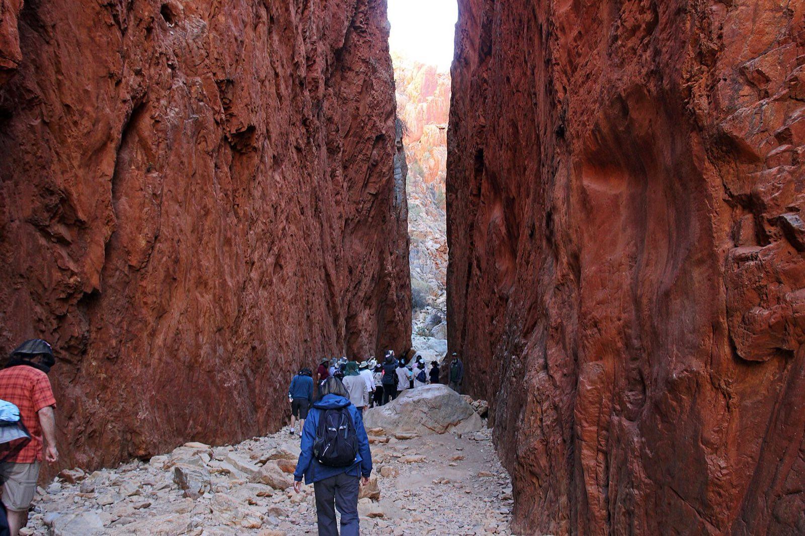
Standley Chasm (Angkerle Atwatye) in the West MacDonnell Ranges Photo: scott1346 from Mechanicsville, MD, USA, CC BY 2.0, via Wikimedia Commons (https://commons.wikimedia.org/wiki/File:Standley_chasm_(47846617632).jpg) Day 2: Down the highway to Kings Canyon
Alice Springs to Watarrka National Park by the Stuart and Lasseter highways and Luritja Road
- Drive about 5 h
- Breakfast, lunch and dinner
- Stay in Kings Canyon
Day 2 details
Today is the trip's one long drive, about 470 km and five hours on sealed roads, and it is long for a reason: the only shorter link, the Mereenie Loop, is mostly unsealed gravel that needs a permit and a four-wheel drive. We break it every hour or two. We leave at about 8:30 after breakfast, run south on the Stuart Highway to Erldunda for coffee, then turn west on the Lasseter Highway and north on Luritja Road through red dunes and stands of desert oak. Lunch is a sit-down meal at Kings Creek Station, a cattle station on the way in, and we reach Watarrka National Park, Luritja country, by mid-afternoon. After a rest at the hotel, the Kings Creek walk, about 2.6 km return on the flat, follows the shaded creek bed to a platform under the canyon walls, which rise more than 100 metres. We watch the George Gill Range turn red at sunset, then eat together.
Included
- Drive from Alice Springs to Kings Canyon with stops at Erldunda and Kings Creek Station
- Sit-down lunch at Kings Creek Station
- NT Parks pass for Watarrka National Park
- Kings Creek walk with your guide
- Sunset over the George Gill Range
- Dinner at Kings Canyon
Optional experiences
- Light Towers, a light installation at Kings Canyon Resort, after dark (price shown at booking)
Free time: An hour or two to rest before the Kings Creek walk
Activity: About 5 hours of driving, on sealed roads, broken by a coffee stop and lunch. The Kings Creek walk is about an hour on the flat.
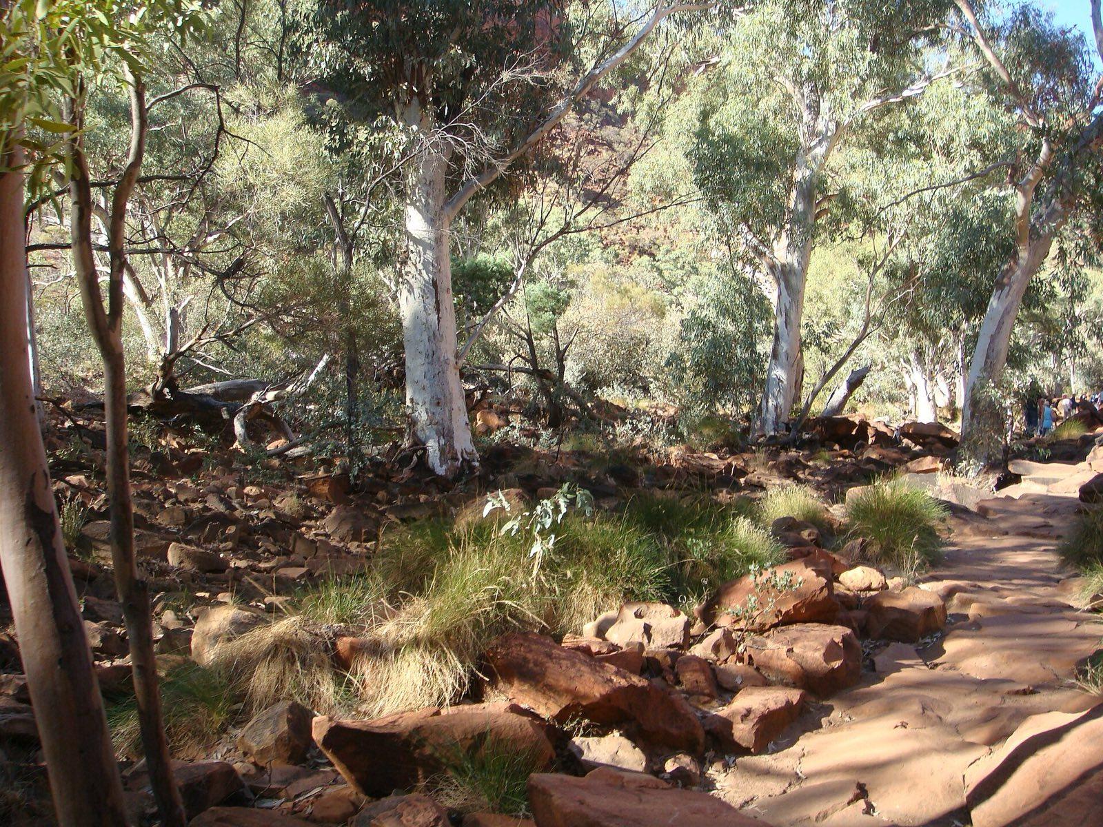
Ghost gums along the Kings Creek walk, Watarrka National Park Photo: Jorge Láscar from Australia, CC BY 2.0, via Wikimedia Commons (https://commons.wikimedia.org/wiki/File:Lascar_Kings_Creek_at_the_gorge_of_the_canyon_(4563009062).jpg) Day 3: The Kings Canyon rim, then Uluru at sunset
Kings Canyon Rim Walk, then Watarrka to Uluru-Kata Tjuta National Park via Curtin Springs
- Drive about 4 h
- Breakfast and lunch
- Stay in Ayers Rock Resort (Yulara)
Day 3 details
A light breakfast before dawn, then we are at the trailhead at first light for the Kings Canyon Rim Walk, a 6 km loop of three to four hours. It starts with a steep climb up rough rock steps, the hardest part of the trip, then levels out across the top: through the Lost City, a maze of weathered sandstone domes, down wooden stairs to the Garden of Eden, a permanent waterhole shaded by cycads, and along the south rim with the sheer wall below you. On days forecast at 36 C or more the walk closes at 9 am, which is one reason we start so early. If you would rather not climb, walk Kings Creek again in the early light. Late in the morning we drive about 305 km, some three and a quarter hours, south and west, past the flat-topped mesa of Mount Conner, with lunch at Curtin Springs. In the park we start at the Uluru-Kata Tjuta Cultural Centre, where Anangu explain Tjukurpa, the law that shapes this country, then watch the sun set on Uluru.
Included
- Kings Canyon Rim Walk at first light with your guide (6 km loop, 3 to 4 hours)
- Lunch at Curtin Springs
- Uluru-Kata Tjuta National Park pass (3 days)
- Uluru-Kata Tjuta Cultural Centre
- Sunset at Uluru
Easier option: Skip the climb: walk Kings Creek again in the early light, or rest at the hotel until we leave.
Free time: Dinner tonight is not included, on purpose: after a pre-dawn start most guests want an early, simple meal at the resort and an early night before the Uluru sunrise.
Activity: One steep climb at the start of the Rim Walk, then uneven rock and stairs. The walk closes at 9 am on days forecast at 36 C or more. About 3.75 hours on the road in all: some 305 km to Yulara, plus the park roads to the Cultural Centre and the sunset area.
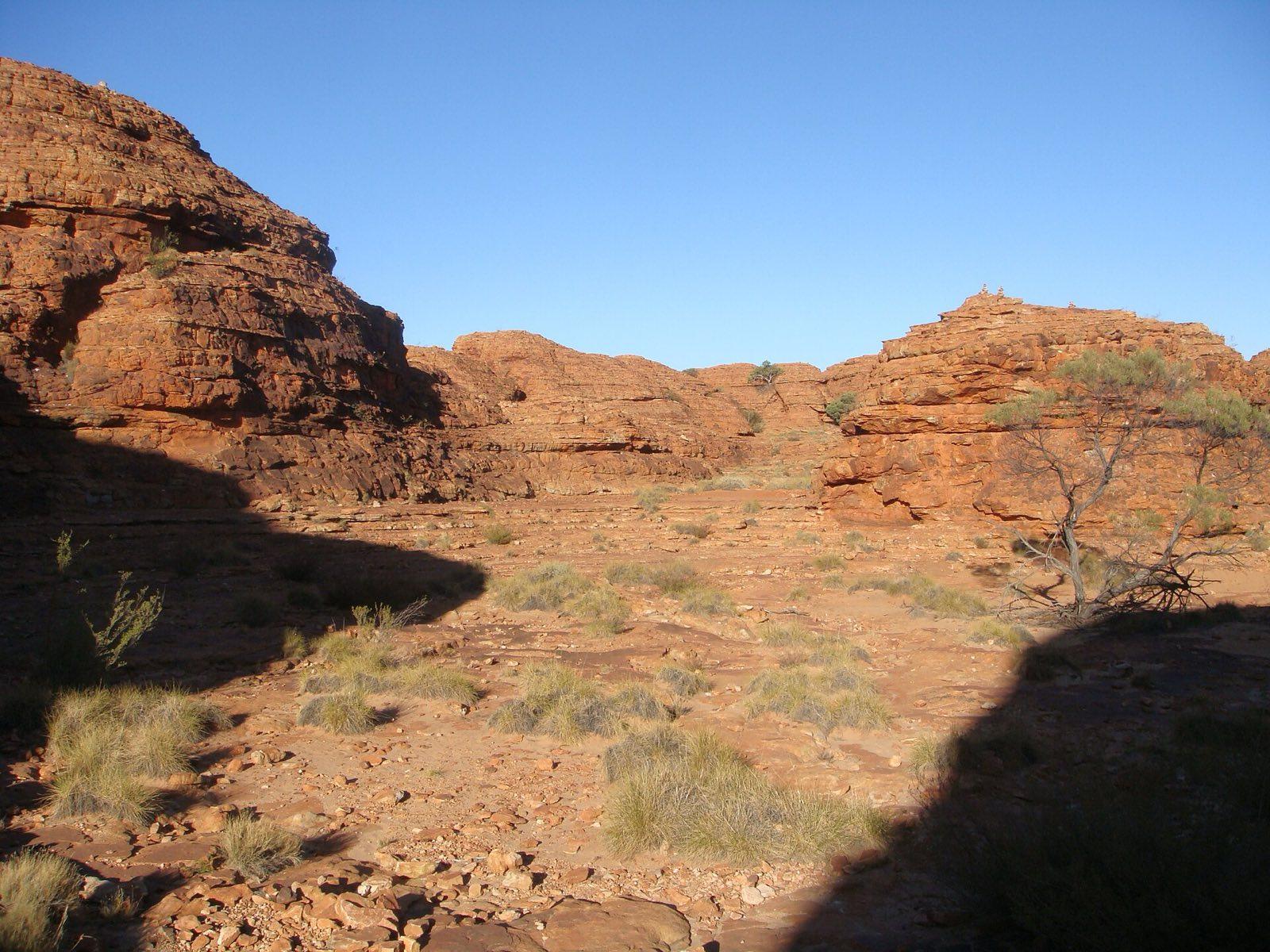
Sandstone domes on top of Kings Canyon, along the Rim Walk Photo: Jorge Láscar from Australia, CC BY 2.0, via Wikimedia Commons (https://commons.wikimedia.org/wiki/File:Lascar_Beautiful_landscape_on_top_of_the_canyon_walls_(Ring_Walk)_(4562382031).jpg) Day 4: Uluru at dawn and the Field of Light
Sunrise and the base walk at Uluru, a free afternoon in Yulara, the Field of Light
- Drive about 1.5 h
- Breakfast, lunch and dinner
- Stay in Ayers Rock Resort (Yulara)
Day 4 details
We watch sunrise from Talinguru Nyakunytjaku, the dune viewing area on the east side of Uluru, then walk while the air is cool. The full base walk is about 10.6 km on flat, sandy paths, around three and a half hours, past caves, rock art, waterholes and the folds and gullies you never see from the sunset area. Uluru rises about 348 m above the plain, and up close it is not one smooth surface but a landscape of its own. Some places along the base are sacred sites: signs ask you not to photograph them, and we ask the same. If you would rather walk less, your guide leads the Mala walk, about 2 km return, to Kantju Gorge, then the short Kuniya walk to Mutitjulu Waterhole, the rock's permanent water. Lunch is together in Yulara, then the afternoon is free. Before sunset your guide walks with anyone who likes up the short sandy path to Imalung Lookout in the village, for the last light over the dunes. Then we share a farewell dinner, then walk among the more than 50,000 solar-powered lights of Bruce Munro's Field of Light under the desert stars.
Included
- Sunrise at Uluru from Talinguru Nyakunytjaku
- The Uluru base walk with your guide, or the Mala and Kuniya walks
- Lunch in Yulara
- Sunset walk to Imalung Lookout in Yulara with your guide
- Farewell dinner
- Field of Light
Optional experiences
- Sounds of Silence dinner among the dunes, in place of the farewell dinner
- Camel ride at sunrise or sunset
- Helicopter flight over Uluru and Kata Tjuta
- (prices shown at booking)
Easier option: The Mala walk to Kantju Gorge and the Kuniya walk to Mutitjulu Waterhole, about 3 km in all, with the vehicle between them.
More active option: The full 10.6 km base walk around Uluru.
Free time: Afternoon free in Yulara: the pool, a rest or the resort's shops, before the Imalung Lookout walk at sunset
Activity: The base walk is flat but long and has little shade after mid-morning; carry about a litre of water for every hour.
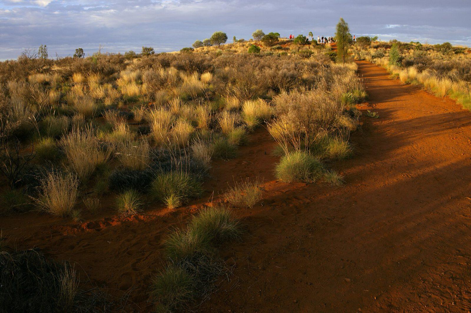
The path to Imalung Lookout in Yulara, our walk before the farewell dinner Photo: Querent, CC BY 4.0, via Wikimedia Commons (https://commons.wikimedia.org/wiki/File:Climb_to_Imalung_Lookout,_Yulara.jpg) Day 5: Kata Tjuta at sunrise, then fly home
Kata Tjuta at sunrise and the Valley of the Winds, then Ayers Rock Airport
- Drive about 1.5 h
- Breakfast
Day 5 details
An early start for sunrise at Kata Tjuta, about 50 km west of Yulara, so pack a warm layer. From the dune viewing area you watch first light reach its 36 domes of conglomerate rock; the tallest, Mount Olga, stands about 546 m above the plain, some 200 m higher than Uluru. Kata Tjuta means many heads in the Pitjantjatjara language, and it is a sacred place under Anangu law whose stories are mostly not shared with visitors. Then we walk while it is cool: the Valley of the Winds trail to Karingana Lookout, about 5.4 km return over loose stones, looks down into a valley ringed by domes. On very hot days the trail beyond Karu Lookout closes early; we confirm the cut-off when you book. For a gentler walk, Walpa Gorge is about 2.6 km return up a stream bed between two of the highest domes. We are back in Yulara by late morning, and your guide sees you to Ayers Rock Airport (AYQ), about ten minutes away, so book a flight leaving after about 1:30 pm.
Included
- Sunrise at Kata Tjuta
- Valley of the Winds walk to Karingana Lookout, or the Walpa Gorge walk
- Drop-off at Ayers Rock Airport (AYQ) or Ayers Rock Resort
Easier option: Walpa Gorge, about 2.6 km return on a gentle stream bed, or the Valley of the Winds only as far as Karu Lookout (about 2.2 km return).
More active option: The full Valley of the Winds loop, about 7.4 km, when the forecast allows.
Activity: Book a flight leaving after about 1:30 pm. If you would like more time at Uluru, we can book extra nights at the resort.
Wildlife and weather: We run from April to October. April, May and September are warm by day and cool at night; June to August brings clear days around 20 C and nights near or below freezing, so the sunrises are cold. By October the days are hot again and the heat closures on the Rim Walk and the Valley of the Winds come into play, which is why we walk early. Bush flies are busiest in the warmer months. Black-footed rock-wallabies are likely at Simpsons Gap in late light, and galahs and other parrots are everywhere; kangaroos and dingoes are possible but not certain.
4 nights
Where you'll stay
Your hotels are named in your trip confirmation.
- Alice Springs1 night
- Kings Canyon1 night
- Ayers Rock Resort (Yulara)2 nights
One price
What's in the price
Included
Accommodation
- 4 nights in hotels of at least a 3-star-plus standard, each room with its own bathroom: 1 in central Alice Springs, 1 at Kings Canyon and 2 at Ayers Rock Resort in Yulara
- Rooms shared, or your own for a supplement
Transport
- Pick-up at Alice Springs Airport (ASP) and drop-off at Ayers Rock Airport (AYQ)
- A private air-conditioned vehicle with a licensed local driver, for our group only, about 1,140 km over five days
Your guide
- A See Sight Tours guide with the group from arrival to departure, trained in the plants, animals and Aboriginal culture of the Red Centre
Activities
- Uluru-Kata Tjuta National Park pass (3 days)
- NT Parks pass for Tjoritja-West MacDonnell and Watarrka national parks
- Standley Chasm (Angkerle Atwatye) entry and Simpsons Gap
- Kings Creek walk and the Kings Canyon Rim Walk
- Uluru-Kata Tjuta Cultural Centre
- Sunset at Uluru
- Sunrise at Uluru and the base walk, or the Mala and Kuniya walks
- Field of Light
- Sunrise at Kata Tjuta and the Valley of the Winds or Walpa Gorge walk
Meals
- 4 breakfasts
- 3 lunches: at Kings Creek Station, Curtin Springs and in Yulara
- 3 dinners: a welcome dinner in Alice Springs, dinner at Kings Canyon and a farewell dinner in Yulara
Not included
- International flights, and your domestic flights to Alice Springs and home from Ayers Rock
- Australian ETA or eVisitor
- Travel insurance
- Lunch on days 1 and 5, and dinner on day 3
- Drinks
- Optional experiences, such as the Sounds of Silence dinner, a camel ride, Light Towers at Kings Canyon or a helicopter flight
- Tips
- Personal expenses
Extras
- Room of your own
- CAD 645 (estimated price)

See Sight Tours has been providing travel services across North America since 2006. Operating in 20 cities across Canada and the USA, the company specializes in small group tours that offer personalized, high-quality experiences for travelers.


Book your Tour
Get in Touch
- Toll Free1-888-961-6584
- Local1-289-271-9767


© 2026 See Sight Tours. All rights reserved.